Bunkers Overlook – A Legacy
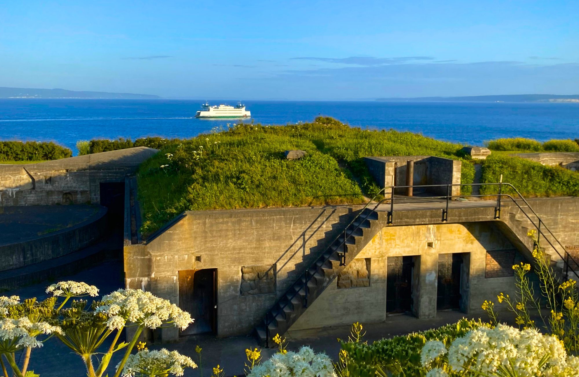
The Fort Casey bunkers located in Coupeville sit perched atop the cliffs overlooking Admiralty Inlet. They stand as silent sentinels of the past, remnants of a bygone era when coastal defense was paramount. These imposing structures were originally built during World War I for coastal defense. They were designed to house artillery and troops and served as a strategic vantage point to protect the Puget Sound & PNW coast. Today, they offer a unique historical attraction for visitors. As you explore the bunkers, you may also catch a glimpse of Washington State Ferries gliding gracefully through the shimmering waters of Puget Sound, a reminder of the region’s maritime legacy and its enduring connection to the sea.
Photo taken by: @PNWBirdie
Check out the rest of Whidbey’s beautiful destinations from this series here.
A Perfect Day Trip
Looking for a perfect day trip that blends scenic beauty, small-town charm, outdoor adventures, and a healthy dose of local flavor? Look no further than Whidbey Island. Discover this hidden gem just north of Seattle that feels a world away.
From the moment your ferry glides across the water, or you cross the iconic Deception Pass Bridge, you’ll feel the shift – like you’ve stepped into a slower, sweeter rhythm of life.
Morning: Start with a Ferry Ride & Fresh Brew
There’s something magical about starting your day on a boat. Hop on the Mukilteo-Clinton ferry and enjoy stunning views of the Puget Sound, as you glide toward adventure. Once you land, swing by one of the island’s many cozy coffee shops. You’ll find Sunshine Drip, Cedar & Salt Coffee House, Beaver Tales Coffee LLC and so many more just in Coupeville.

Midday: Nature, Shops & Island Charm
Now that you’re caffeinated, it’s time to explore Coupeville! Nature lovers won’t want to miss a scenic bluff hike, or beach walk at Ebey’s Landing, or the Sculpture Forest on Parker Road. Want something a bit more laid-back? Stroll the charming streets of historic downtown Coupeville, where you’ll find an independent bookstore, antique shops, art galleries and more. At the end of the wharf, you’ll find Beaver Tales Coffee and Tea, Harbor Gifts, Penn Cove Outfitters, & Wharf Dog Paddle & Pantry. Don’t forget to look up and spot Rosie and friends once you’re inside.
Don’t leave without grabbing something to eat. There is something for everyone at one of the many eateries in town. You can find burgers, fish and chips, pizza, Mexican, Thai, and more. Choose from Toby’s Tavern, Front Street Grill, Osprey Fish Co., Molka Xete, Goldies, Phad Thai, Pizza Factory, and Oystercatcher.
Afternoon: Culture, History & Local Finds
Whidbey isn’t just about beaches and views — it’s rich with history and culture. Tour historic Fort Casey to explore the bunkers, and climb the lighthouse for panoramic views. If art is more of your thing, pop into one of the many local galleries or check out the rotating exhibits at the Pacific Northwest Art School in Coupeville.
If you happen to be visiting during one of the island’s many festivals or markets — lucky you! The community really comes alive with live music in the summertime with the Sound of Summer Concerts & Oak Harbor Music Fest. Or find fresh produce and handmade goods that show off the island’s creative soul at the Bayview Farmers Market, Coupeville’s Farmers Market, and Oak Harbor Farmers Market.
Evening: Sunset, Sips & Serenity
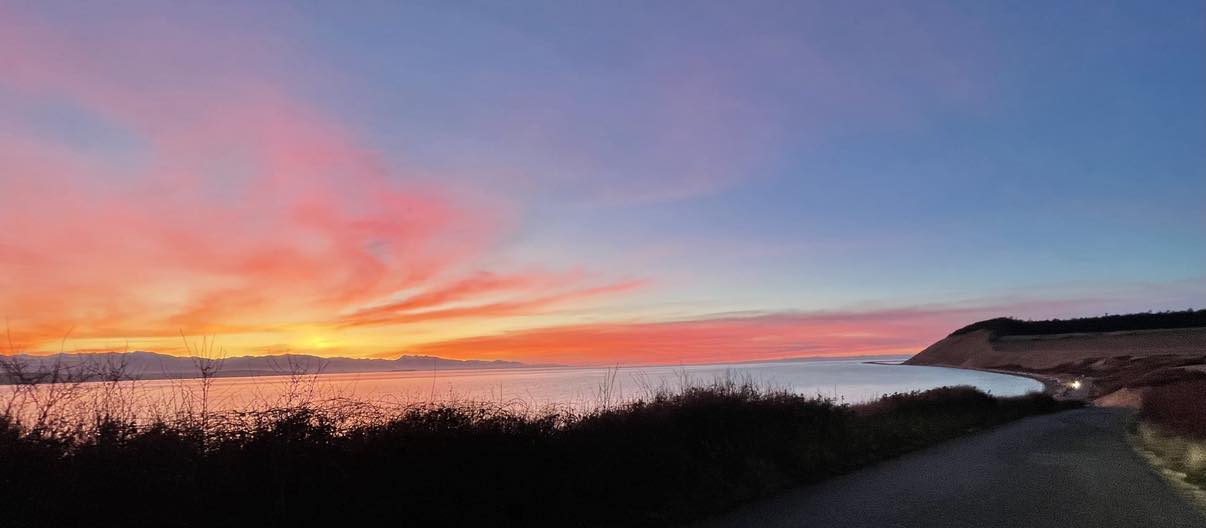
As your perfect Whidbey day winds down, find a spot to watch the sunset. We suggest heading to Deception Pass or West Beach. Grab a blanket and soak in the golden glow as the sun slips behind the Olympic Mountains and listen to the waves roll in. If a relaxing drink is more your style, settle in at a local winery or brewery for a glass of something delicious made right here on the island at Spoiled Dog, or Holmes Harbor Cellars.
Why Whidbey?
A day on Whidbey is more than just an escape — it’s a reset. It is a reminder that the best adventures don’t require boarding a plane or mapping out weeks of travel. Sometimes, all you need is a day, a ferry ride, and a little curiosity.
What are you waiting for? A perfect day trip is a short distance away. Your Whidbey Island day trip is calling. Come for the views, stay for the charm, and leave with your heart just a little fuller. Or fall in love and stay forever. If that’s the case, we can help make that happen. Let’s connect.
The Development of Deception Pass
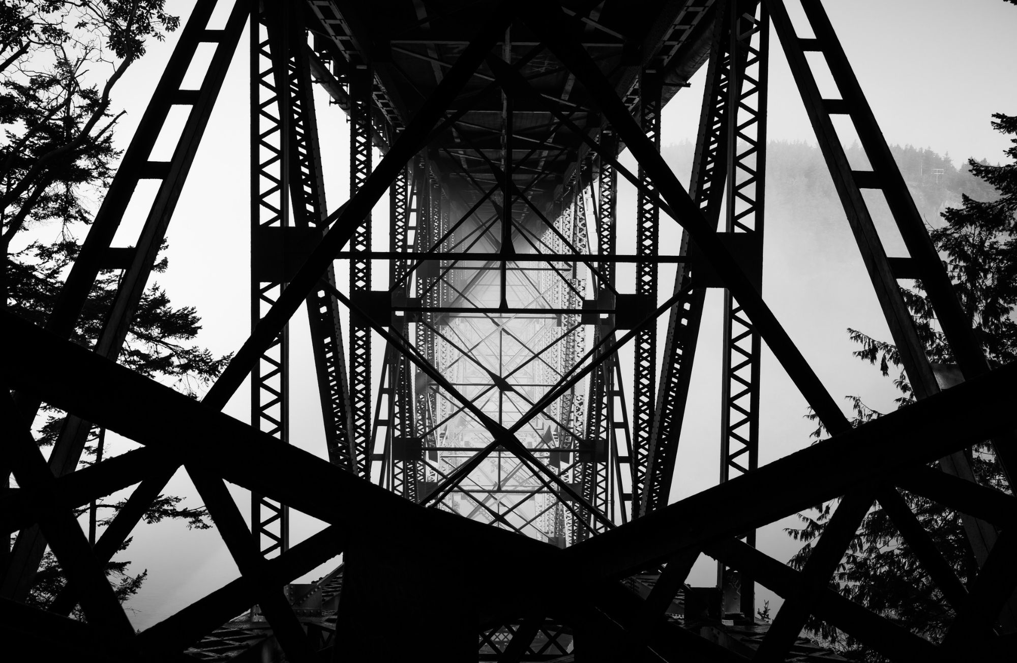
Recognized for its breathtaking beauty and stunning engineering, the Deception Pass Bridge is one of the most iconic landmarks in Washington State. Spanning the turbulent waters of Deception Pass and connecting Whidbey Island to Fidalgo Island. The bridge has become a symbol of the Pacific Northwest’s natural and manmade wonders, drawing countless visitors each year.
Admiralty Light House History
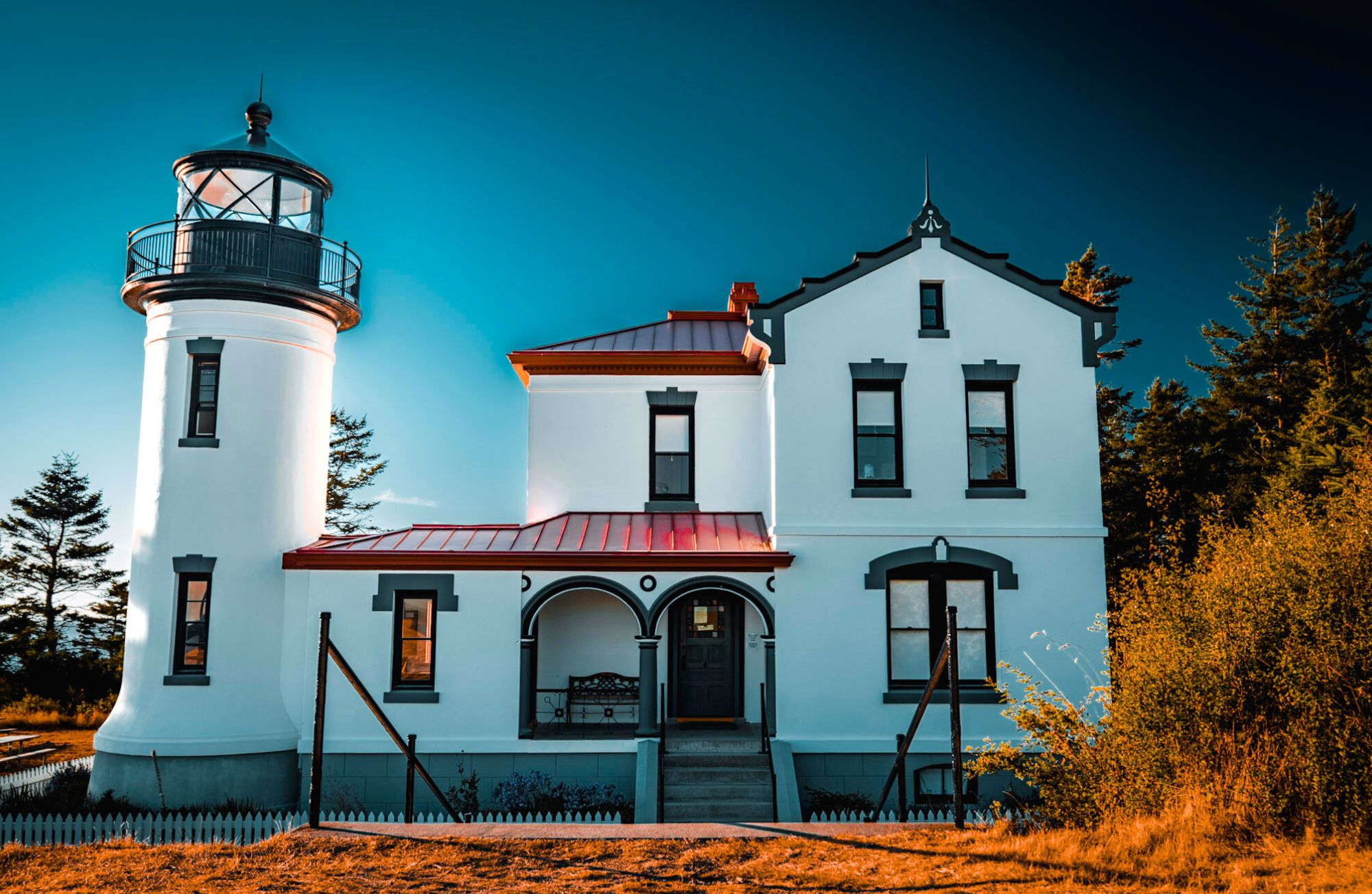
Photo by: @pnwdeparture
If you’re sailing into Admiralty Inlet from the open ocean Point Wilson sits to the West of you and Admiralty Head to the East. This entrance to the vast inland waters of Puget Sound is marked by lighthouses on either side to alert ship traffic at night. Let’s review some of Admiralty Light House History. The original Admiralty Head lighthouse was built in 1861 and had similarities to a church. It was later rebuilt in 1903 and decommissioned in 1922. Today it remains an iconic historical part of Fort Casey State Park. When open, the interpretive center features a real Fresnel Lens along with a fantastic collection of historic photos and even a gift shop. A Spiral Staircase leads to the lookout where you can enjoy expansive views of Puget Sound, the Olympic mountains, and watch the ferry as it crosses to Port Townsend.
Check out the rest of Whidbey’s beautiful destinations from this series here.
A Trip Through Whidbey’s History
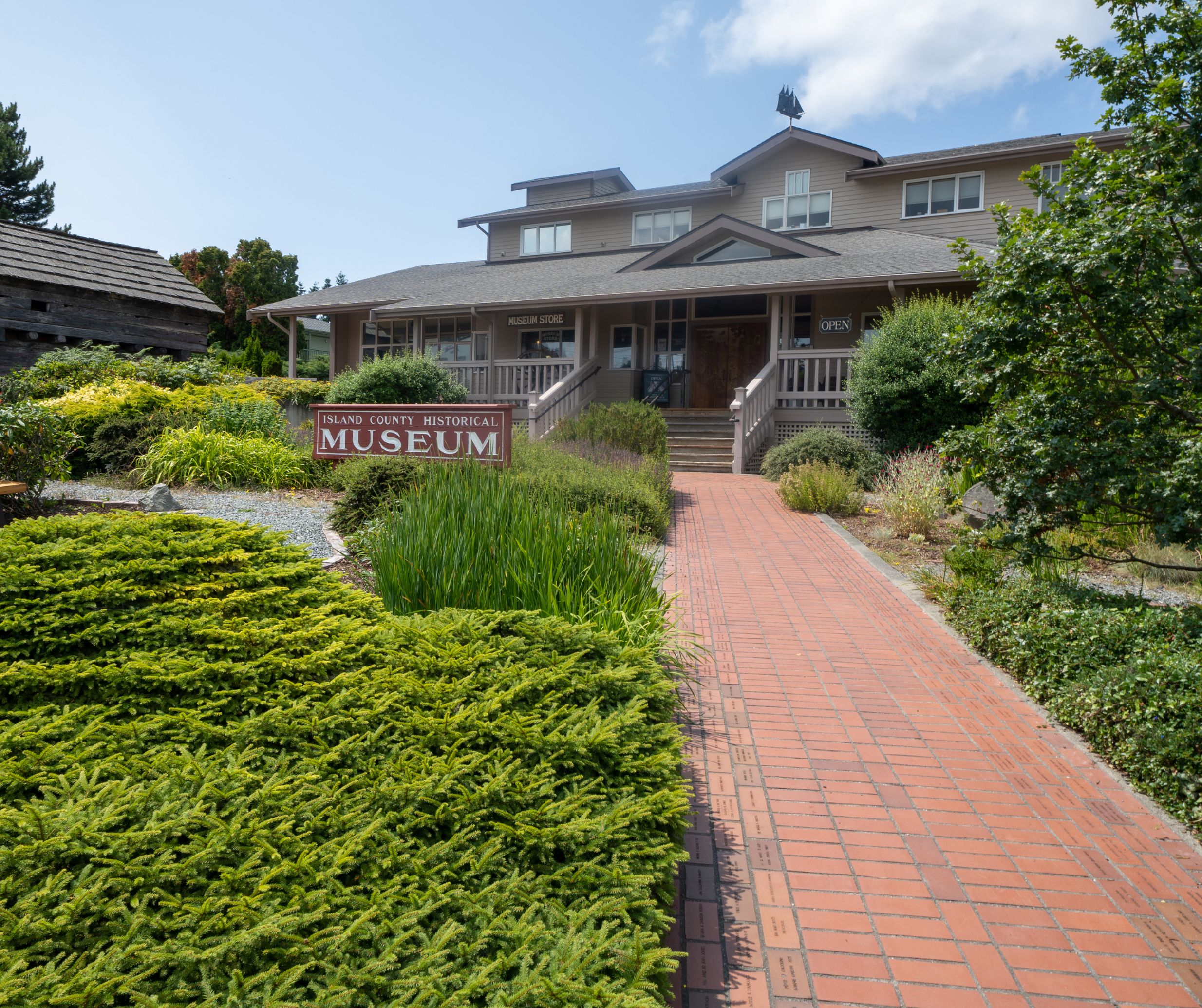
Whidbey has history? It must; there are museums here. Compared to any place in Europe it can seem that there’s no real history here; but, Whidbey has had visitors for thousands of years. Follow along with us as we take a trip through Whidbey’s history.
The island was built from some of the newest geology:
The west coast of North America was originally at Spokane, but tectonic plates moved and eventually some small ones slammed into the continent. That’s where “The Rock” gets its rocks. They hold up our bridge. Further south on the island could arguably be called “The Gravel” because a series of glaciers and ice sheets scraped mountains down to bits. Those bits were dumped into moraines and stream beds that help explain the south end’s hilly roads, as well as some of the slopes that slide.
About 16,900 years ago, those ice sheets finally left. Over 2,000 feet of ice retreated, leaving lands that waited for something to drop by and grow. The plants began to grow providing forests and prairies. The whales, fish, birds, and land creatures arrived. Today you can walk the beach and you may find mammoth teeth and bones (not a joke).
People came soon after:
They didn’t call it Whidbey. One name that became associated with the place was Tscha-kole-chy. Ask the Tulalip tribes or a local historian about how to pronounce it.
The island became populated just like the rest of the Salish Sea lands. There was food, a good climate, and relative safety from things like volcanoes.
Humans were busy for over ten thousand years, but we have few stories considering how long that period lasted. One good view of that life is the Maiden of Deception Pass sculpture and description.
Skip ahead a few thousands of years to when more people started showing up.
In the late 1700s:
European explorers sailed in. They were to explore the island and discover what existed here, a very natural and human endeavor. Captain Vancouver’s crew named many of the features. The features already had names, but now they had newer names.
1792:
Joseph Whidbey circumnavigated the island. Originally, they thought it was a peninsula, but when they completed their counter-clockwise trip and found the pass they were surprised it was an island, hence Deception Pass.
By 1848:
Some settlers tried settling on the west side of island, near Penn Cove. Thomas Glasgow, Antonio Rabbeson, and A. Carnefix established a farmstead. It didn’t last long. Local tribes were upset in general with settlers throughout the Puget Sound region. The settlers were encouraged to leave, which they did, without even taking many of their tools.
There was some disagreement between the Spanish, the British, and the pesky Americans as to who owned what. The original inhabitants had their perspective, of course. The various negotiations and treaties are complicated and fascinating. One place to start is with the Pig War on San Juan Island, a seemingly silly disagreement that almost started a real war.
The 1850’s:
Soon after, more settlers arrived. They too saw the value of the forests, farming, and fishing. Coupeville got started in the 1850s, and became the second oldest town in Washington State. The south end towns were quieter; but, Maxwelton had a 3,000 seat auditorium, for a while. The site of Bailey’s store was basically a trading post in the 1850s. Oak Harbor started then, too; and was incorporated in the 1910s.
The island was fractured. There were few roads. The main way to get around was by boat or walking the beaches at low tide.
It was about this time that Ebey’s tale became history, a fascinating story of someone who regularly rowed to Port Townsend, and then was killed over a misunderstanding. Check out the links at the end of this article if you would like to learn more about this story.
The next few decades were a bit rough, but profitable for some. Seattle was growing and it became the destination for island food and lumber. Some of the island’s tallest trees became masts for that era’s tall ships. The branches went into the growing steamship fleet’s boilers, as well as into the landfills that became Seattle’s waterfront.
Throughout those decades ships turned from oars or paddles, to sail, to steam, to internal combustion (to electric?).
Ships operated before docks were built. Some ran up onto the beach, got rid of cargo and passengers, picked up more, and backed away before the tide stranded them. A ferry carried people across Deception Pass, before the bridge was built.
1897:
The construction of Fort Casey began. After one world war it became obvious that the country needed defenses. The Navy established its base, and added and shifted as technology changed warfare. Look at the guns at Fort Casey and compare them to the fortifications at Fort Ebey to see a great change in a short time.
Boeing was busy during World War Two, but it was a few decades later that their plant at Paine Field became a major employer. Thanks to the ferries, Whidbey also became a bedroom community.
1900’s:
Meanwhile, after the start of the 20th century, Freeland was started as a place for free land, an experimental community that blended and contrasted socialist and capitalistic principles. Eventually, the culture tended to a more conventional style of community.
In 1919:
Ferries began docking at docks on south Whidbey, not just running up on beaches, and it became possible to ferry cars and trucks onto the island. They probably had wait lines and cancellations, too.
In 1920:
Langley became one of the first cities in America to have an all-women government. They inaugurated a series of reforms that cleaned up the town, literally.
About that time, some of the other rough edges of Whidbey were softened as artists began using the island as a retreat and refuge.
Thanks to fishing resorts, Whidbey was already gaining a reputation as a place to get away from The Big City of Seattle. Tourism got a beachhead.
It became obvious to some that Whidbey’s relationship with Seattle could be like the East Coast’s tourist towns relationship between cities like New York and the Hamptons. That tourist traffic became yet another reason to justify the Deception Pass Bridge.
Life in general became easier as the entire island was finally connected with roads and power.
1990’s:
By the end of the 90s, Whidbey was already known for its various communities: farming, the arts, for tourists, for commuters, and for retirees. Currently, it is being redefined again as Whidbey’s rise from obscurity has grown into an international destination for tourism and training.
What’s next? Being remote is redefining itself. Whidbey Island is being ‘found’. De-urbanization means urban dwellers are trading that lifestyle for something quieter and slower with a bit more room. But, what’s really next? That’s what every resident and visitor and fan gets to help redefine. History never ends. Welcome to this chapter, the one that you are in. What history will you create?
Connect with us whether you already live here, visit often, or want to move here.
Ridge Trail At Ebey’s Landing
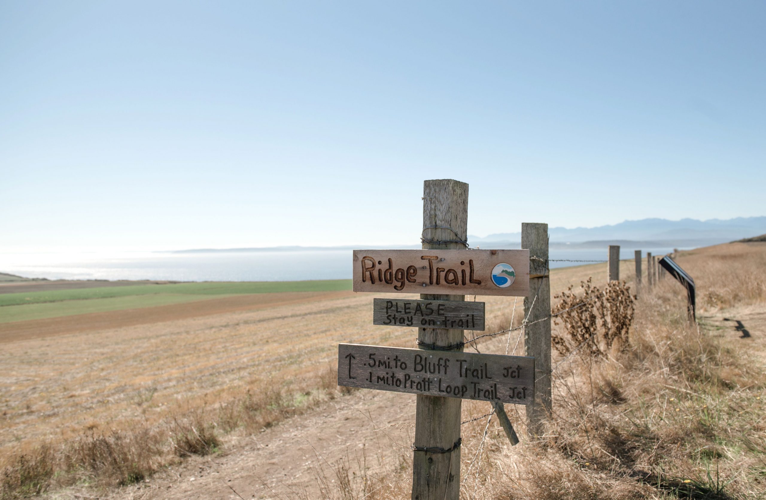
It’s great to start the Ridge Trail in Ebey’s Landing at Sunnyside Cemetery. See if you can find the two monuments that originally stood in the first Ebey Graveyard located on Ebey’s Prairie near Isaac and Rebecca Ebey’s home. You will discover a plethora of history about Whidbey Island here but don’t forget to stop and enjoy the view! The trail takes you past Jacob Ebey’s house and blockhouse on your journey towards the edge of the bluff. At the ‘T’ you can follow the trail left to the Ebey’s Landing Parking lot at the beach or head right for some impressive views along the bluff. It’s your choice to continue down the switchbacks to the lagoon below and you can follow the beach back OR turn around for an out and back.
Check out the rest of Whidbey’s beautiful destinations from this series here.
Fort Casey State Park: Unique History and Breathtaking Views
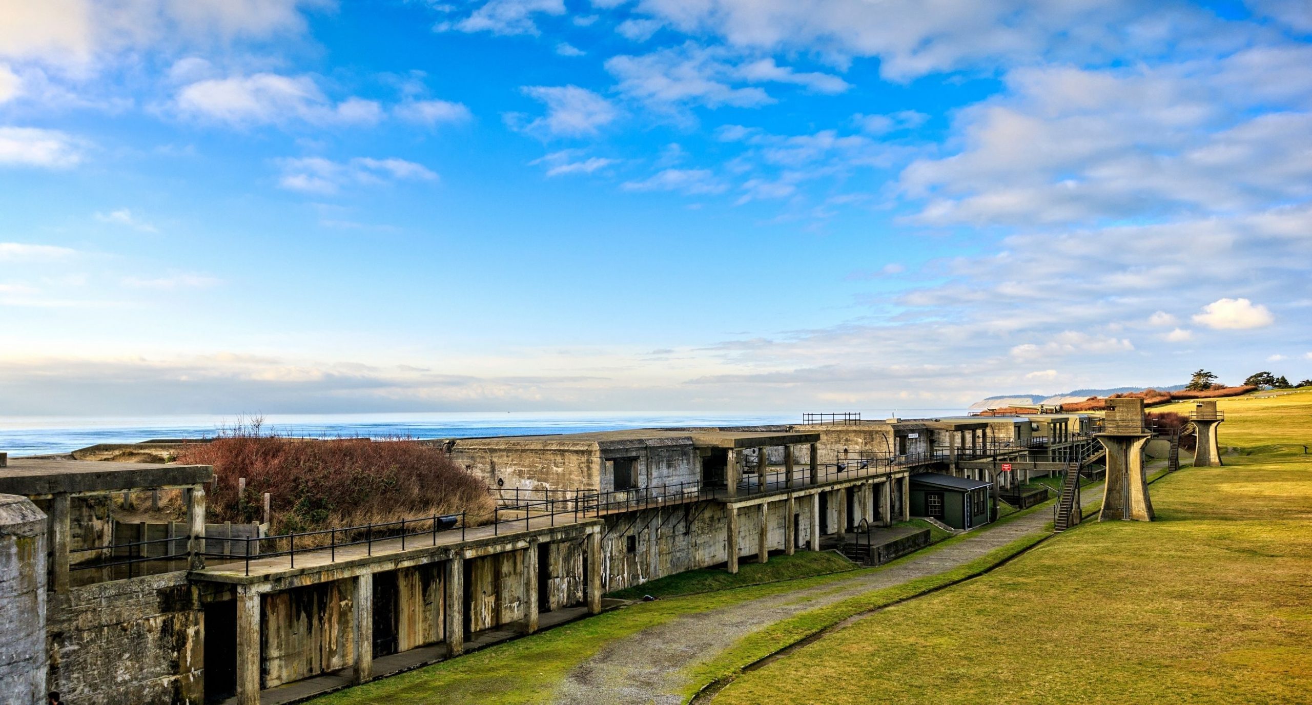
Located on Whidbey Island, Fort Casey State Park is a great place to visit for those looking to explore the Pacific Northwest and Whidbey Island. It’s hard to pick just one thing that makes this place so special! So we picked three!

#1 The park’s location is perfect for history buffs who also love the outdoors. There are miles of trails winding through forests filled with towering Douglas Fir trees, open grassy fields, and dotted throughout are all the historical infrastructure. It affords several unique photo opportunities from the expansive water views, military relics like the large cannon guns, the infamous Admiralty Head Lighthouse, and fauna like bald eagles and deer.

#2 There are so many stories associated with this one location. History buffs will learn about the Civil War-era military fort that was built here in order to protect against a potential invasion via water from Japan or Russia during World War II with the “Triangle of Fire. The Admiralty Head Lighthouse adds another slant of historical intrigue. The original lighthouse, which was built in 1894 and first lit on January 21st of 1895 could be seen as far away as 14 miles with a focal plane of 128 feet above the high tide line. You can now visit the lighthouse in its expertly restored state and learn from the volunteer docents that keep the small museum housed inside. Learn more here http://www.washingtonlighthouses.org/data/lighthouse_ah.html

#3 So many ways to stay! If a day trip is not long enough to soak it all in you can book a campsite at the base of the bluff on the Southern end of the park. It’s located on a bit of a sandy plateau right next to the Ferry landing that serves the Washington State Ferries Port Townsend to Coupeville route. In fact, a neat feature of weekend camping here is that you can walk on the Ferry and explore the historical Water Street in Port Townsend! Grab an amazing meal from one of Port Townsend’s excellent restaurants just don’t miss the last ferry back! If that sounds too risky then head over to Callens Restaurant for some of Coupeville’s best food and drink. If camping accommodations is not your thing you can stay at Camp Casey with a variety of accommodation types. Check it out here https://casey.spu.edu/staying-at-camp-casey/lodging/
Whichever you choose, a day trip or an overnight stay at Fort Casey State Park is sure to leave you with some one-of-a-kind memories!
Fort Ebey Fort
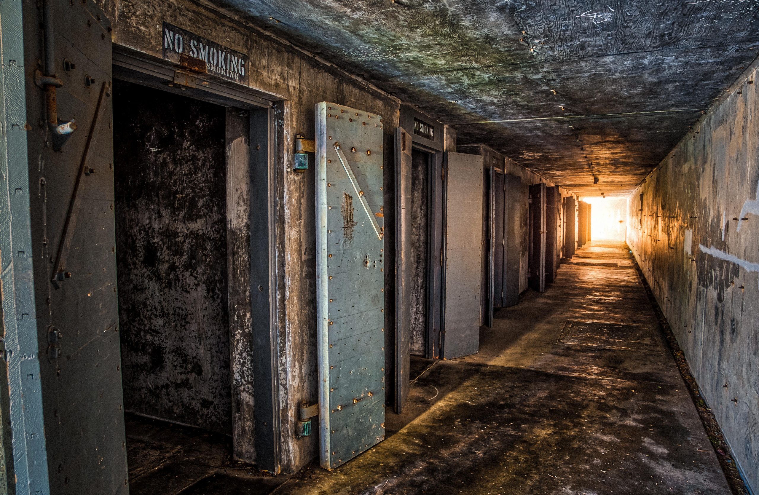
Treading toward the pinhole of light at the end of the dark tunnel, you hear the creak of an old metal door as it’s caught by a slight breeze. Your steadiness escapes you as you break into a firm sprint until your eyes see the safety of the trees and vista. It’s hard to keep your imagination at bay when visiting Fort Ebey’s eerie bunkers. Built in 1942 as part of the coastal defense system for World War II, Fort Ebey was home to a state-of-the-art battery with two 6-inch guns. When its usefulness ran out, the property was purchased by the state who chose to keep elements of the old battery when opening up the park, making it possible for thousands to explore and enjoy these thrilling bunkers every year.
Ebey’s Landing
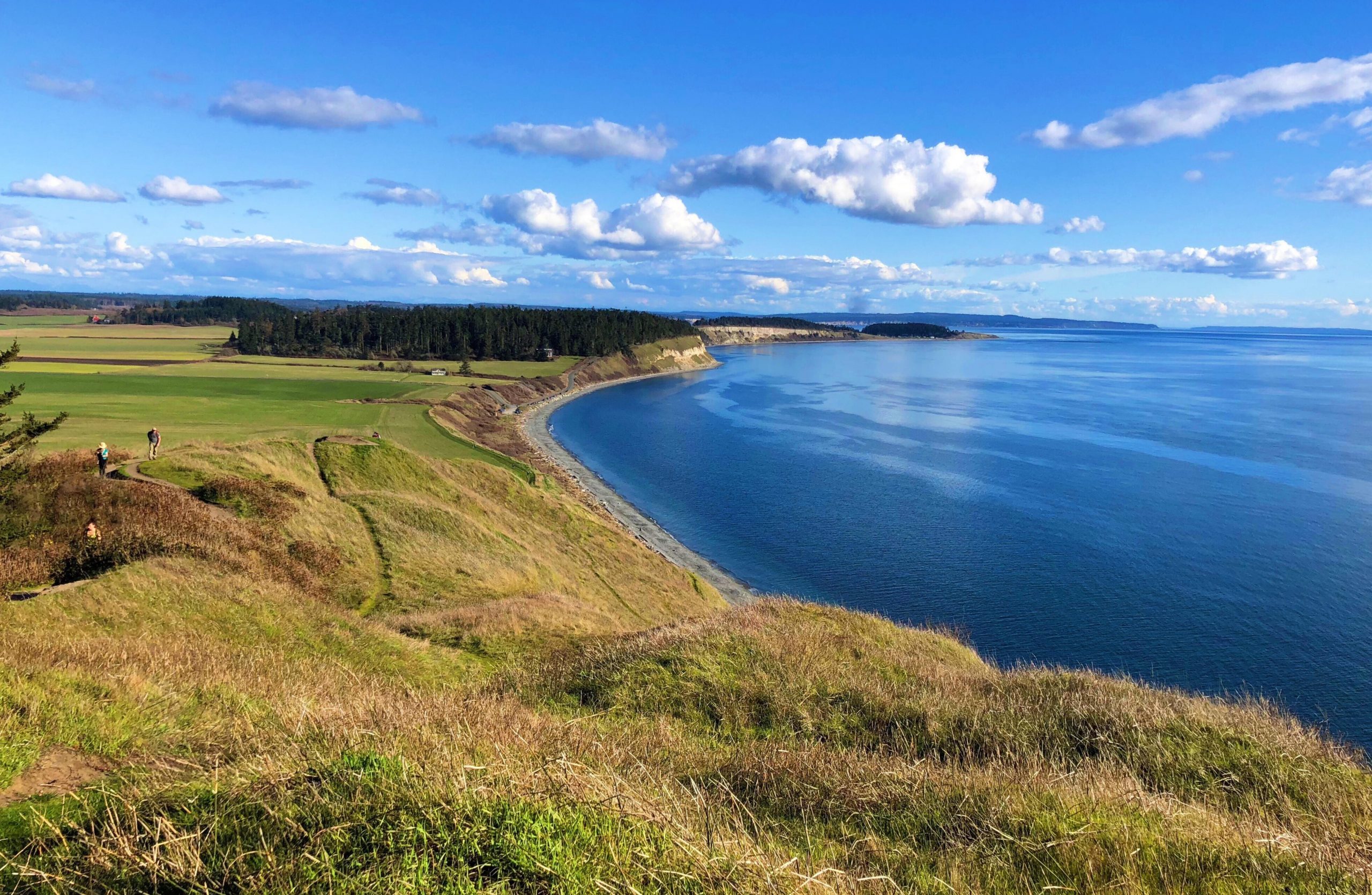
In 1850, local history was made on the shores of Whidbey Island when Isaac Ebey landed on a rocky westside beach and became the first official white settler on the island. With an entire island to choose from, Ebey couldn’t have done much better than the pristine pastureland of what is now known as Ebey’s Landing. This brilliant landscape is situated right at the southwestern side of Coupeville and features breathtaking views of Puget Sound and the Olympic Mountain range. The landing’s soft rolling hills blanketed in rich soil—perfect for cultivating crops—was this area’s true draw to its original settler. Today this landscape remains largely unchanged from the early days of settlers thanks to Ebey’s Landing Reserve. It’s the perfect place for a long walk to get lost in the life of the past.

 Facebook
 X
X
 Pinterest
 Copy Link

