 Facebook
 X
X
 Pinterest
 Copy Link
2026 Homestay Program
There’s something special about real estate bringing people together from completely different corners of the world. We recently got the perfect reminder of that! One of our brokers, Karen Cox, had the absolute pleasure of hosting Undraa. Undraa is a talented realtor who visited us all the way from Mongolia as a part of the Washington REALTORS ® 2026 Homestay Program. As part of their ongoing global initiatives, this program offers members of the Mongolian ambassador association a unique opportunity to experience the day-to-day life of REALTORS® in the U.S. The experience also provides U.S. REALTORS® valuable insight into the impact and importance of Washington REALTORS®’ global partnerships.
A True Cultural Exchange
From the moment Undraa arrived, it felt like a true cultural exchange rooted in shared passion, curiosity, and a love for helping people find the beautiful sanctuary they will call home.

Karen Cox said:
“Having gone to Mongolia last year, I was excited to host a Mongolian agent. I never met Undraa on my trip to Mongolia with Washington Realtors®, but we discovered we were in some of the same photos from the Realtor’s Voice Forum I attended in Mongolia.”
The Experiences
One of the best experiences was when Undraa offered to cook us a Mongolian meal. She made us Khuushuur (fried dumplings) and Buuz (steamed dumplings). They were delicious! She explained their whole family gets together on holidays and makes these. Like us cooking for Thanksgiving, but on a larger scale because they often have all the extended family there too.”


During her time here, Undraa and Karen explored the beauty of Whidbey Island together, touring a variety of listings and soaking in everything that makes this place so unique. From waterfront views to quiet countryside properties, it was a chance to not only showcase our local market, but to see it through a fresh set of eyes.
The Connection
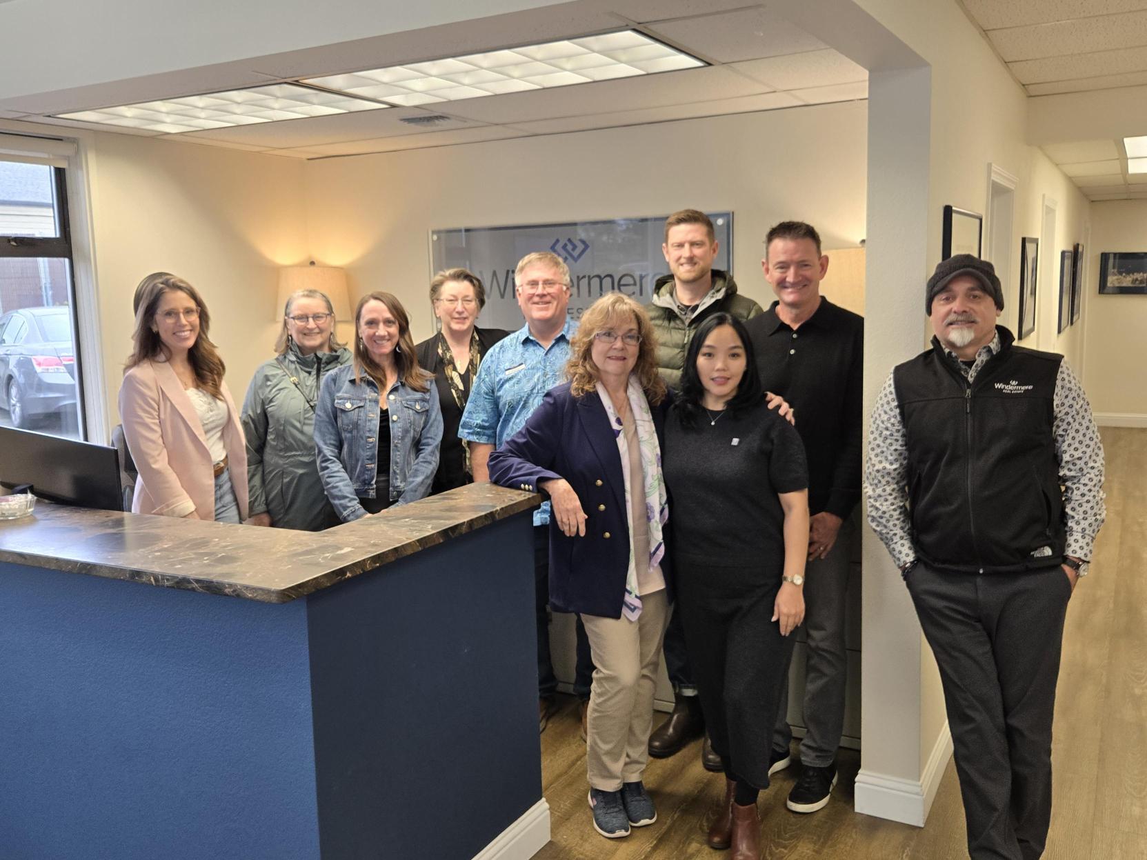
We loved having the chance to host lunch to welcome her to Whidbey Island! Brokers from both our Coupeville and Oak Harbor offices convened to connect with each other and with Undraa to share meaningful conversations and listen to her experiences. After lunch, we got the chance to see a presentation from Undraa on the real estate processes in Mongolia, insights about how she serves her clients, and the differences between real estate in Mongolia versus here! From differences in property ownership to the pace and structure of transactions, it was fascinating to compare and realize just how global (and yet personal) this industry truly is.


But beyond the business side, what made this visit unforgettable were the moments in between.
Undraa spoiled us with thoughtful gifts from Mongolia, each one carrying a piece of her home and culture. And then, she went a step further—preparing us a traditional Mongolian dinner that brought everyone together around the table. It wasn’t just delicious (though it absolutely was); it was meaningful. Food has a way of connecting people, and that evening was more than just a meal; it was the blossoming of a beautiful new friendship.
The 2026 Homestay Program Success Story
Experiences like this remind us that real estate isn’t just about properties—it’s about people, stories, and connections that stretch far beyond borders.
We miss her already.
Thank you, Undraa, for sharing your knowledge, your culture, and your kindness with us. Enjoy the rest of your time in the U.S.! We’ll be cheering you on from Whidbey Island!
Coming Together for a Cause

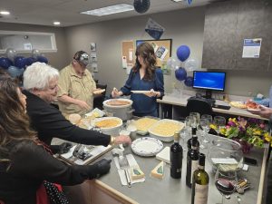
There is something special about coming together for a cause and gathering around a table with good food, great company, and a shared purpose. Recently, our Windermere Real Estate Oak Harbor and Coupeville offices on Whidbey Island did just that. Agents Simona Groves and Jonathan Young hosted a home made spaghetti lunch fundraiser that brought together agents from both our Oak Harbor and Coupeville offices.
A memorable afternoon
The event was filled with all the ingredients for a memorable afternoon: wine, spaghetti and meatballs, fresh baked sourdough, and a delicious banana pudding. Beyond the meal itself, the day was about connection, generosity, and giving back to the Whidbey Island community that we are so proud to call home.


As Simona, who organized the event, shared:
“We were so excited to host an Italian lunch to support the Windermere Foundation, featuring wine, spaghetti and meatballs, fresh baked sourdough, and a delicious banana pudding. It turned into such a fun and meaningful gathering, bringing agents from both our Oak Harbor and Coupeville offices together to not only raise funds, but to enjoy a great meal and spend some time connecting with one another.
Most importantly, every dollar raised goes directly to the Windermere Foundation, helping support local families and funding the scholarships we offer to students pursuing careers in the trades. It’s a beautiful reminder that when we come together, even something as simple as sharing a meal can make a meaningful difference in the lives of others.”
Thanks to the generosity of everyone who attended and contributed, the event raised an incredible $1,170 for the Windermere Foundation.
The Windermere Foundation
Those funds will go directly toward supporting local low-income families with children and providing scholarships to students seeking to continue their education and pursue careers in the trades. It’s a mission that is deeply important to our offices, and one we are honored to support year after year. We are currently accepting scholarship applications till April 30th. If interested in applying, please fill out the application here.
Events like this are a reminder that community is about more than where we live but rather about how we care for one another. We are so grateful to everyone who helped make this event such a success and are proud to be part of a community that continues to show up with generosity and heart.
The Colonel’s House
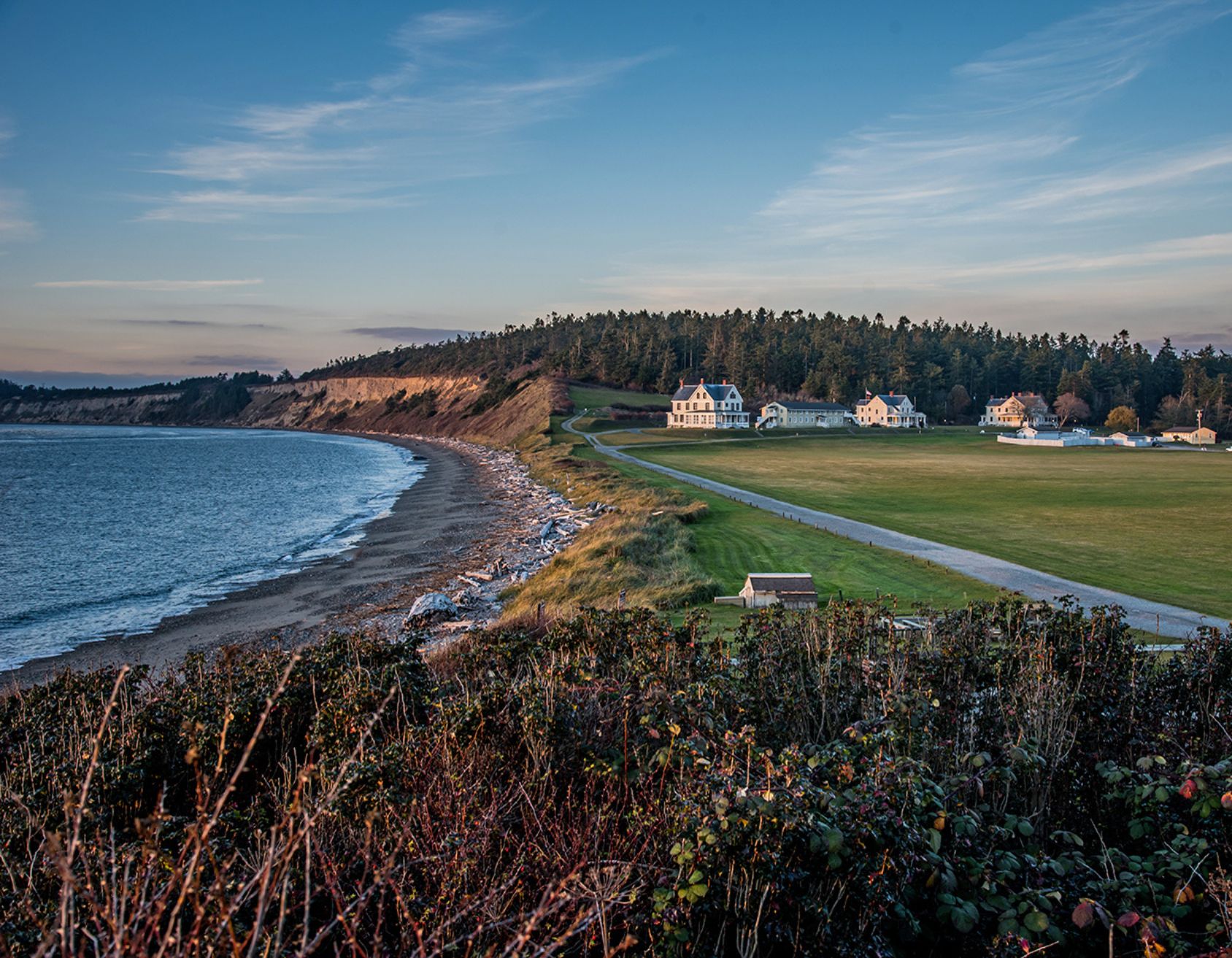
In a word, The Colonel’s House is imposing. Not in a scary way, but in a “yes sir, right away sir” kind of way. Once the commanding officer’s quarters at Fort Casey, this grand 1904 home stands with the quiet authority of a place that’s seen things yet still manages to keep its porch pristine.
The Colonel’s House Today
These days, the Colonel’s House has traded its military roots for a softer kind of mission. Today, it is part of Seattle Pacific University’s Camp Casey Conference Center. The Colonel’s House hosts families, couples, and groups looking to reconnect and recharge. The home blends historical elegance with modern comfort. Much of the original charm remains, from creaky stairs to the sun porch that guests never want to leave. But don’t worry, the kitchen’s fully updated for all your pancake-flipping needs.
From its perch above the old parade grounds, the view is nothing short of breathtaking. You can see straight across Admiralty Inlet, where the Strait of Juan de Fuca meets Puget Sound. It’s the kind of view that makes you stop, breathe a little deeper, and wonder how you got so lucky to be standing there. If you’re quiet, you might just hear echoes of the past carried on the breeze.
Outside Adventure Calls
Beach strolls, forest trails, whale sightings, bald eagles, and sunsets that stop you in your tracks are all part of the experience at The Colonel’s House. While you’re visiting, be sure to explore the nearby town of Coupeville. You can spend your day taking beautiful pictures at the Wharf, grabbing a bite at Toby’s Tavern (famous for its mussels), enjoying fresh pastries at Little Red Hen Bakery, or shopping for handmade goods at Kingfisher Bookstore and Lavender Wind. It’s small-town charm at its finest. Better yet, it’s all just minutes away.
Whether you’re here for the history, the view, or just some well-earned rest, the Colonel’s House has a way of making you feel like you belong, right in the heart of its story.
Ready to call Whidbey home? Let’s Connect!
Photo By: Cynthia Woerner Photography
The Ferry House at Ebey’s Landing
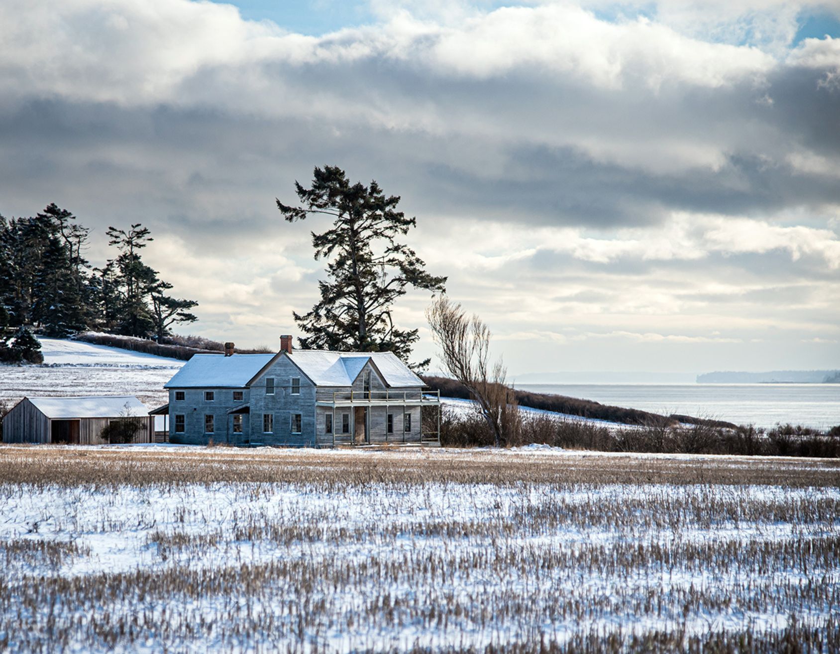
If Whidbey Island had a heartbeat, it would echo across the open prairie at Ebey’s Landing. Few places capture that steady rhythm quite like the Ferry House. This enduring landmark reflects the island’s history, character, and quiet sense of place. Whidbey’s story lives on through the Ferry House at Ebey’s Landing.
The Ferry House at Ebey’s Landing History
Built in the early 1860s atop the Ebey family’s original 640-acre land claim, the Ferry House sits high above Puget Sound, overlooking Ebey Prairie and the waters that have long connected Whidbey Island to the mainland. Long before “water views” or “heritage homes” became real estate buzzwords, this home served a practical and welcoming purpose. Travelers arriving by boat found warmth, rest, and a sense of arrival here. It was the first impression of Whidbey that was as gracious then, as it feels today.
The Ferry House at Ebey’s Landing Today
What makes the Ferry House especially compelling is how beautifully intact it remains. The home stands not only as a preserved structure, but as a living reminder that some properties are more than addresses. They are storytellers! They have borne witness to generations of change while remaining deeply rooted in their surroundings. In a world where newness often takes center stage, the Ferry House represents the enduring value of authenticity.
Magic of The Ferry House at Ebey’s Landing
In winter, the property takes on an added layer of magic. A light snowfall softens the prairie grasses, the roofline gathers a quiet dusting of white, and ferries move almost silently across the sound below. It’s peaceful and grounding, a scene that feels both cinematic and deeply familiar. Moments like this capture what so many are seeking today: calm, connection, and a lifestyle that elevates everyday life.
The Community
This is the essence of Ebey’s Landing and the surrounding communities. Protected open space, unobstructed views, and a commitment to preservation define the landscape. Here, history isn’t confined to just commemoration plaques or museums, it’s woven into daily life. Morning walks trace the same paths settlers once traveled. Seasonal changes unfold across the same horizons that have framed the island for more than a century.
Homes near Ebey’s Landing offer something increasingly rare. Beyond square footage, finishes, or amenities, they provide a connection…to the land, to the water, and to a story that continues to evolve. Living here means sharing space with history while enjoying the comforts and rhythms of modern island life.
In that sense, the true luxury of Whidbey Island isn’t found in excess, but in meaning. It’s found in places like the Ferry House, where past and present coexist, and where home is defined not just by walls and views, but by the life that unfolds around them.
If you have experienced the magic of the Ferry House at Ebey’s Landing and wish to make a move to Whidbey to enjoy the experience all year long, lets connect!
Photo taken by: Cynthia Woerner Photography
Real Estate Ranking in Puget Sound

The Puget Sound Business Journal released real estate rankings that truly made us proud to be part of Windermere (check them out here). Windermere has been a long standing leader of market leadership in the Puget Sound area and this report confirms that has not changed. The report claims Windermere Puget Sound did $21.32 billion in residential sales volume in 2024, surpassing the closest competitor by nearly a threefold. The report demonstrates how Windermere Real Estate continues to assert its position as the foremost residential real estate firm in the Puget Sound region.
The history:
The Puget Sound Business Journal inaugurated its list of top residential real estate companies in 1986. Windermere has maintained the No. 1 ranking every single year. This nearly four-decade tenure spotlights not only Windermere’s market share but its sustained organizational resilience, strategic adaptability, and strong community presence. We are proud to be a part of the success.
Factor of Success:
Several factors contribute to Windermere’s enduring success. First, its expansive network across the Pacific Northwest supports unparalleled market coverage and client reach. Second, the emphasis on agent education, technological integration, and customer-centered service has strengthened its professional reputation and operational efficiency. Finally, Windermere’s deep-rooted commitment to community engagement. The Windermere Foundation, funded in part by a portion of every home sold sets Windermere apart as both a market leader and a socially responsible organization. As Windermere offices and agents in the Puget Sound, we couldn’t be more proud.
Here is a snip-it into what our Oak Harbor and Coupeville offices have been doing in our communities recently:


What it all means:
Windermere’s continued ability to maintain leadership at such scale suggests a robust alignment between regional market demands and Windermere’s business model. Housing markets across the Puget Sound area evolve in response to demographic shifts, economic pressures, and ongoing development patterns. Windermere’s legacy of leadership positions it uniquely to shape the future trajectory of real estate services in the region.
In sum, Windermere’s top ranking is not merely a reflection of annual sales. Windermere’s top ranking is a testament to nearly forty years of consistent excellence, strategic foresight, and unwavering commitment to all of the communities served. We are grateful for your continued trust in our services and look forward to continuing to serve you for years to come.
If you are looking to making a move in your future please reach out. We would love to help you. If you wish to have a copy of this document mailed or emailed to you please email us at whidbeycommunications@windermere.com.
Oak Harbor Marina
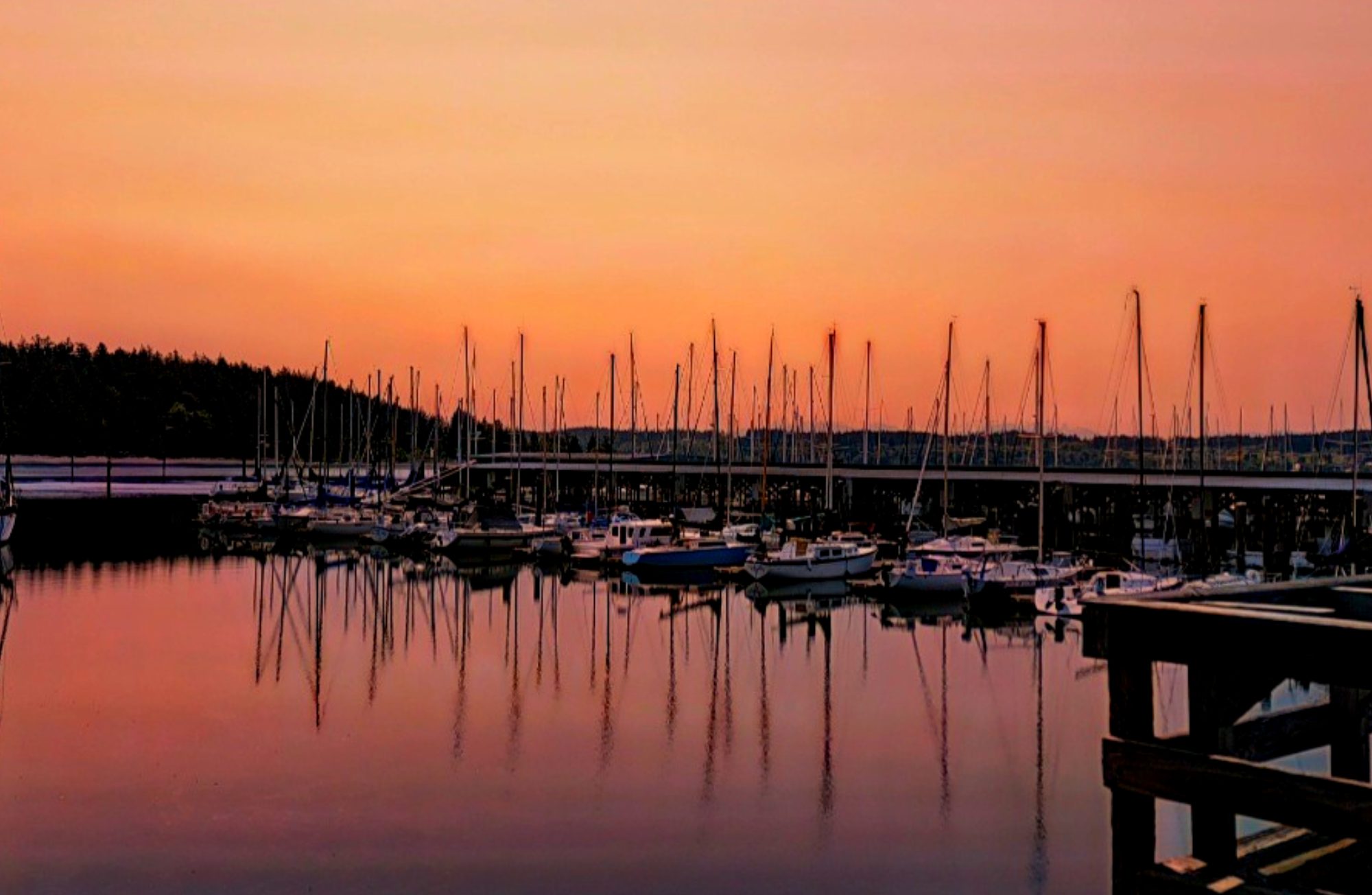
Conveniently located in a northern cove on Whidbey Island sits the Oak Harbor Marina. Its stunning panoramic views of Puget Sound and the Cascade Mountains serve as a gateway to an exceptional nautical lifestyle. Boasting modern facilities and a vibrant community, the marina provides access to various amenities. Charming shops and dining options are within walking distance. Visitors and residents alike can enjoy the convenience of boat launches, fuel docks, and well-appointed guest moorage. The Oak Harbor Marina’s unique location and array of offerings make it a perfect spot to launch from for long trips to the San Juan Islands or Canadian Waters but also for day trips to Penn Cove and the Saratoga Passage.
Learn more about the Oak Harbor Marina here.
If you would like to learn more about Whidbey Connect with us here.
You can also, check out the rest of Whidbey’s beautiful destinations from this series here.

Deception Pass
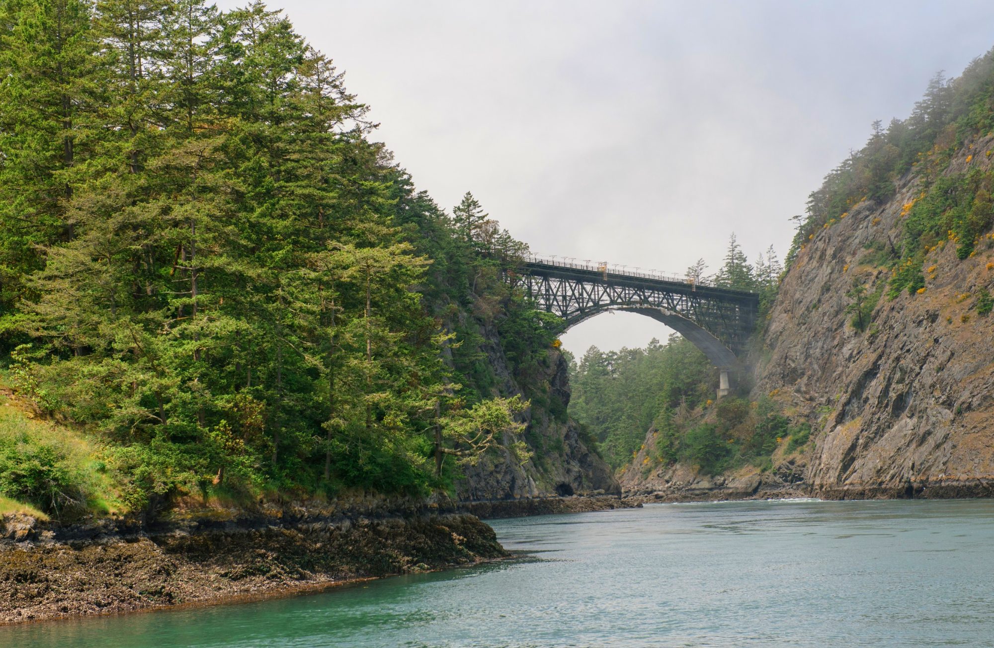
Deception Pass derives its name from its complex and tricky currents that can deceive mariners. It is notorious for its powerful and unpredictable tidal currents that can shift rapidly. Mariners, unfamiliar with the area often found themselves deceived by the challenging conditions. Navigating through the pass required skill and local knowledge to avoid dangerous whirlpools, strong eddies, and turbulent waters. Before European settlers arrived the indigenous tribes relied on the pass as a crucial trade route providing access to prime fishing grounds. Deception Pass holds a place of historical significance, symbolizing the resilient maritime traditions and skills of Native American peoples who thrived in the challenging coastal environment. Their mastery of the pass’s currents & ability to safely navigate its waters contributed to the rich cultural tapestry of the region.
Photo taken by: @KelseyKurtis
Learn more about Deception Pass here.
Check out the rest of Whidbey’s beautiful destinations from this series here.
Cranberry Lake

Nestled within the breathtaking expanse of Deception Pass Park on Whidbey Island, discover Cranberry Lake. There is a phenomenon at Cranberry Lake where the fresh waters are separated from the saltwater of the Salish Sea. The two are separated by a relatively thin strip of sand. This serene lake offers more than picturesque views; it’s a sanctuary for various plant and animal species. The lake’s wetlands provide crucial habitat for migratory birds, and the waters house resident bass and perch or stocked trout. Cranberry Lake’s ecosystem is a testament to the delicate interplay between land and water. Visiting this natural wonder offers tranquility and a chance to witness firsthand the intricate web of life within its shores, embodying the park’s commitment to preservation and natural harmony.
Check out the rest of Whidbey’s beautiful destinations from this series here.
Finding Community on Whidbey Island

Moving to Whidbey Island offers more than just a change of scenery, it’s an invitation to join a warm and welcoming community. Getting involved in local groups and activities is one of the best ways to meet people, stay active, and feel at home quickly.
Here are some great places to start:
Join a Run Club or Outdoor Group
Staying active is easy with Whidbey Island’s natural beauty and abundance of outdoor activities. Consider joining groups like the Whidbey Island Running Club or North Whidbey Hiking Enthusiasts, where you’ll not only get exercise but also connect with like-minded locals. Participating in group runs, hikes, or bike rides is a natural way to form friendships while exploring the island’s scenic landscapes.
Connect with Local Farmers Markets
Whidbey Island is known for its vibrant farmers markets, like the Bayview Farmers Market in Langley or the Coupeville Farmers Market. These markets offer more than fresh produce, they are community hubs with local artisans, farmers, and fellow residents. Grab a coffee, browse handmade crafts, and strike up conversations with friendly faces.
Explore Art and Craft Co-ops
If you have a passion for the arts, there is no doubt that you will love Whidbey Island’s creative community. Visit local co-ops like the Penn Cove Gallery in downtown Coupeville or the Whidbey Art Gallery downtown Langley, where you can meet local artists, attend workshops, or participate in art walks. Engaging in these creative spaces opens the door to new friendships and shared experiences.
Attend Festivals and Local Events
Whidbey Island’s calendar is packed with events that bring the community together. Don’t miss these annual favorites: the Whidbey Island Fair, Coupeville Arts & Crafts Festival, or the Mystery Weekend in Langley. Attending these events is a great way to immerse yourself in local culture, meet your neighbors, and create lasting memories.
Get Involved in Community Groups
Whether you are passionate about gardening, music, or volunteering, it is likely that there is a local group to join. Look into organizations like Whidbey Island Grown Cooperative for agricultural enthusiasts, Island Shakespeare Festival for theater lovers, or volunteer opportunities with Good Cheer Food Bank or Habitat for Humanity. Getting involved is a direct path to building meaningful connections on the island.
Make Whidbey Feel Like Home
The key to settling into a new community is active participation. Whether you are hiking with new friends, attending a lively market, or volunteering at a local event, the connections you make will turn Whidbey Island from a new place into a true home.
Ready to make Whidbey Island your home? Let’s connect.
Why Are There Tsunami Signs on Whidbey Island?
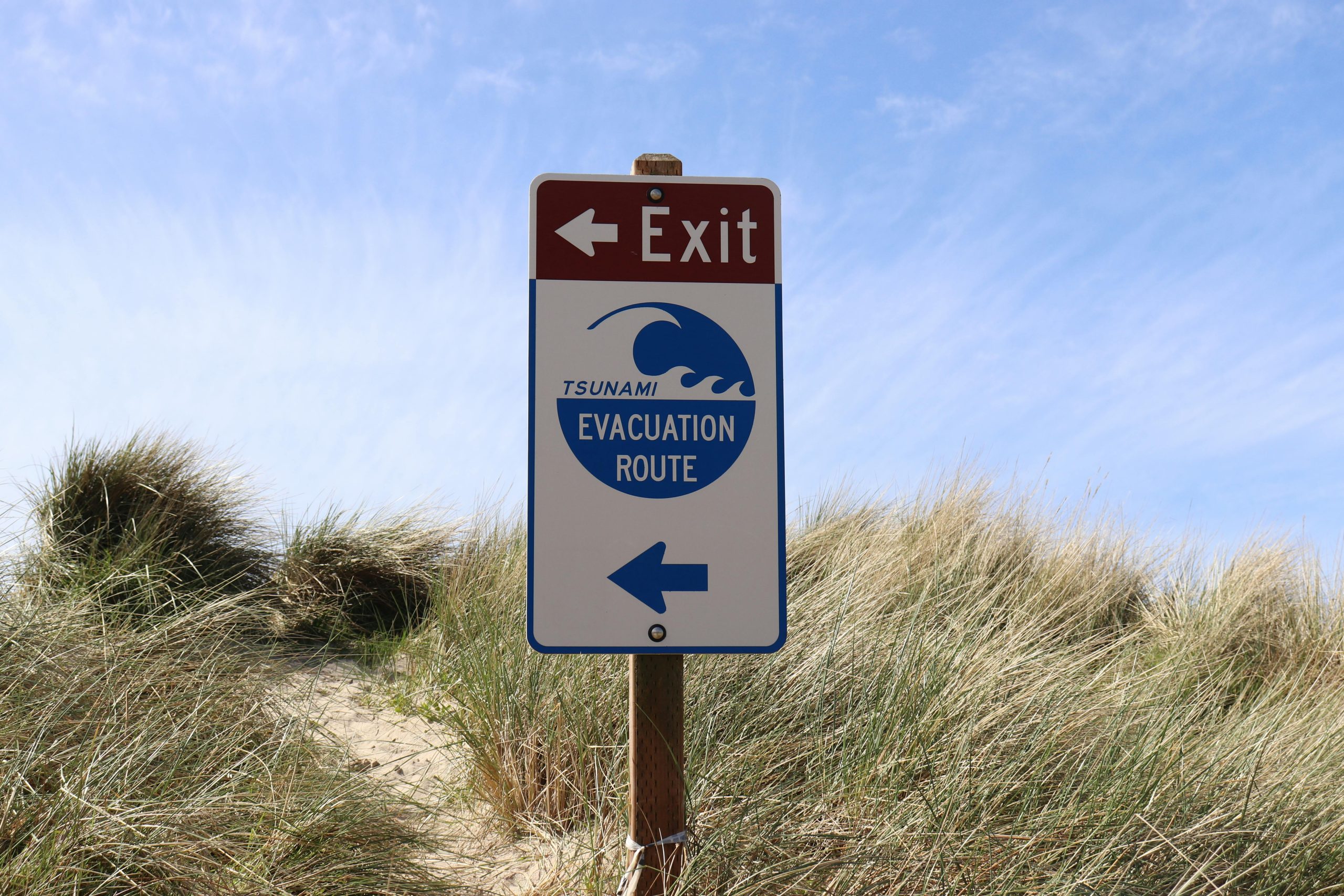
If you have spent any time on Whidbey Island, it is likely that you have noticed the tsunami evacuation signs posted along roads and beaches. These signs may raise questions for newcomers or visitors. Why does an island surrounded by serene waters have tsunami warnings? The answer lies in the region’s unique geography and seismic activity.
The Risk of Tsunamis on Whidbey Island
Whidbey Island is located in part of the geologically active area known as the Cascadia Subduction Zone. Roughly 600-miles of fault line runs from Northern California to British Columbia, where the Juan de Fuca tectonic plate meets the North American tectonic plate. When these plates shift or collide, they can trigger large earthquakes — and in some cases, tsunamis.
Tsunamis are massive ocean waves typically caused by undersea earthquakes or volcanic activity. While Whidbey Island is somewhat sheltered by its location in Puget Sound, a major earthquake along the Cascadia fault or from another undersea event could generate a tsunami that impacts the island’s coastal areas.
Why Are There Evacuation Routes?
The tsunami evacuation signs posted throughout Whidbey Island are part of a broader safety plan to help residents and visitors reach higher ground quickly in the event of a tsunami warning. Coastal towns like Langley, Coupeville, and Oak Harbor have low-lying areas that could be vulnerable to flooding if a tsunami were to occur.
The signs are strategically placed to direct people away from beaches, marinas, and waterfront areas toward safer locations on higher ground. Being aware of these routes and having a plan in case of an emergency is an important part of living in a coastal region. Island County does a great job of providing tsunami information including a high ground map that you can visit by clicking here.
How Likely Is a Tsunami on Whidbey Island?
The likelihood of a large tsunami hitting Whidbey Island is low, but not impossible. Scientists and geologists monitor the Cascadia Subduction Zone closely, and while large earthquakes are rare, they have occurred in the past. The most notable event was the 1700 Cascadia Earthquake, which triggered a tsunami that impacted coastal communities from Washington to Japan. You can read more about what that looked like on January 15, 2022 by clicking here.
While Whidbey Island may not face the same tsunami threats as coastal communities on the open ocean, it is still vulnerable to localized tsunamis caused by underwater landslides, known as “submarine landslides.” These could result from large earthquakes or other geological shifts in Puget Sound.
What Should You Do in the Event of a Tsunami Warning?
In the rare event of a tsunami warning on Whidbey Island, the most important thing to do is move to higher ground immediately. Familiarize yourself with the evacuation routes marked by the tsunami signs, and always follow guidance from local authorities and emergency services.
Here are a few tips to stay safe:
· If you feel strong shaking from an earthquake, don’t wait for an official warning — head to higher ground immediately.
· Know your evacuation routes and have a family emergency plan in place.
· Stay informed by signing up for local emergency alerts and having a battery-powered radio on hand.
Preparedness Brings Peace of Mind
While the thought of a tsunami can be unsettling, it is most important to remember that Whidbey Island’s local authorities and emergency response teams are well-prepared. The presence of tsunami signs and evacuation routes are simply a proactive measure to ensure everyone’s safety.
By staying informed and knowing what to do in an emergency, you can enjoy everything Whidbey Island has to offer with peace of mind. After all, living on this beautiful island means being prepared — and being part of a community that looks out for one another. Connect with us.
