

 Facebook
 X
X
 Pinterest
 Copy Link
Finding Community on Whidbey Island

Moving to Whidbey Island offers more than just a change of scenery, it’s an invitation to join a warm and welcoming community. Getting involved in local groups and activities is one of the best ways to meet people, stay active, and feel at home quickly.
Here are some great places to start:
Join a Run Club or Outdoor Group
Staying active is easy with Whidbey Island’s natural beauty and abundance of outdoor activities. Consider joining groups like the Whidbey Island Running Club or North Whidbey Hiking Enthusiasts, where you’ll not only get exercise but also connect with like-minded locals. Participating in group runs, hikes, or bike rides is a natural way to form friendships while exploring the island’s scenic landscapes.
Connect with Local Farmers Markets
Whidbey Island is known for its vibrant farmers markets, like the Bayview Farmers Market in Langley or the Coupeville Farmers Market. These markets offer more than fresh produce, they are community hubs with local artisans, farmers, and fellow residents. Grab a coffee, browse handmade crafts, and strike up conversations with friendly faces.
Explore Art and Craft Co-ops
If you have a passion for the arts, there is no doubt that you will love Whidbey Island’s creative community. Visit local co-ops like the Penn Cove Gallery in downtown Coupeville or the Whidbey Art Gallery downtown Langley, where you can meet local artists, attend workshops, or participate in art walks. Engaging in these creative spaces opens the door to new friendships and shared experiences.
Attend Festivals and Local Events
Whidbey Island’s calendar is packed with events that bring the community together. Don’t miss these annual favorites: the Whidbey Island Fair, Coupeville Arts & Crafts Festival, or the Mystery Weekend in Langley. Attending these events is a great way to immerse yourself in local culture, meet your neighbors, and create lasting memories.
Get Involved in Community Groups
Whether you are passionate about gardening, music, or volunteering, it is likely that there is a local group to join. Look into organizations like Whidbey Island Grown Cooperative for agricultural enthusiasts, Island Shakespeare Festival for theater lovers, or volunteer opportunities with Good Cheer Food Bank or Habitat for Humanity. Getting involved is a direct path to building meaningful connections on the island.
Make Whidbey Feel Like Home
The key to settling into a new community is active participation. Whether you are hiking with new friends, attending a lively market, or volunteering at a local event, the connections you make will turn Whidbey Island from a new place into a true home.
Ready to make Whidbey Island your home? Let’s connect.
Why Are There Tsunami Signs on Whidbey Island?
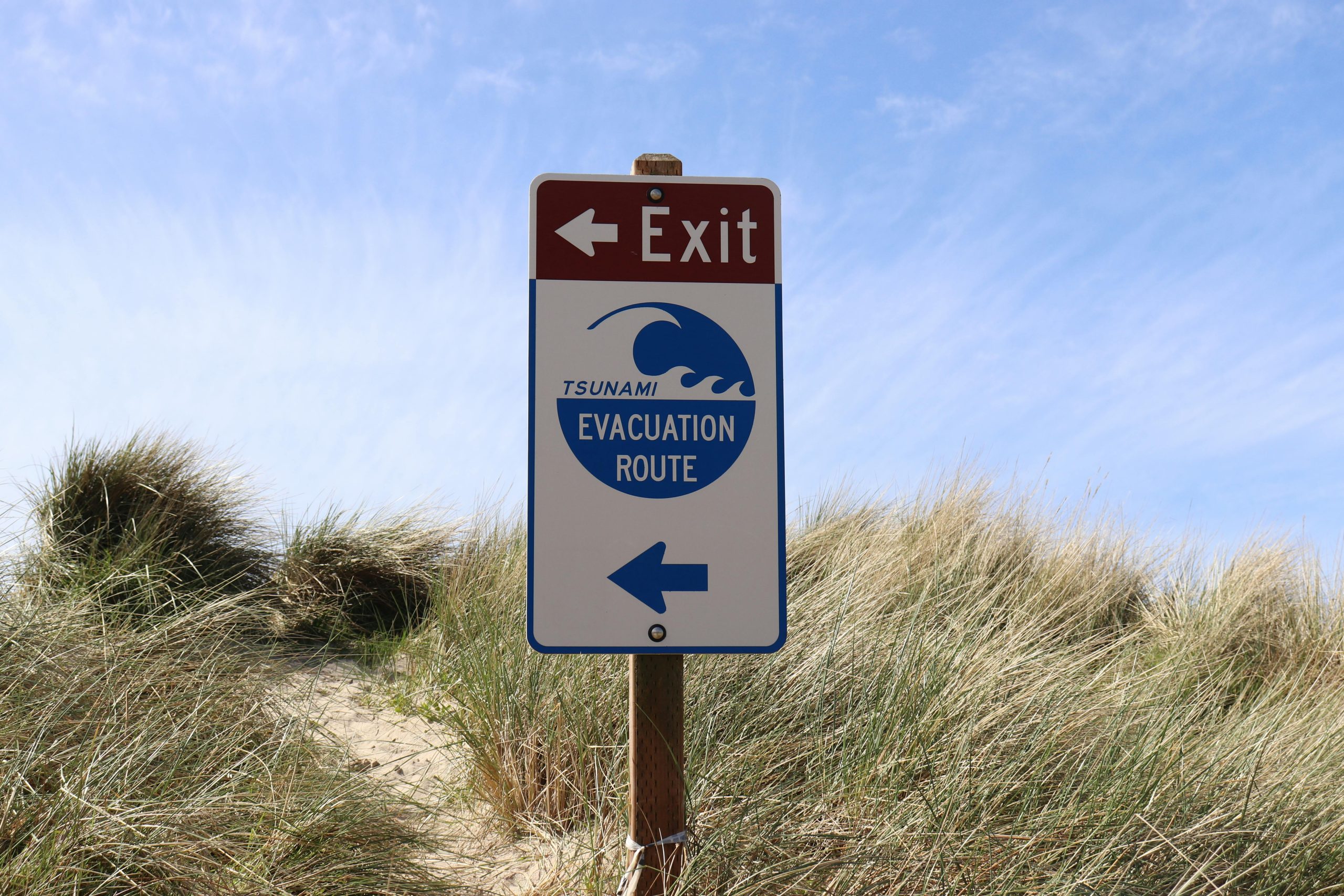
If you have spent any time on Whidbey Island, it is likely that you have noticed the tsunami evacuation signs posted along roads and beaches. These signs may raise questions for newcomers or visitors. Why does an island surrounded by serene waters have tsunami warnings? The answer lies in the region’s unique geography and seismic activity.
The Risk of Tsunamis on Whidbey Island
Whidbey Island is located in part of the geologically active area known as the Cascadia Subduction Zone. Roughly 600-miles of fault line runs from Northern California to British Columbia, where the Juan de Fuca tectonic plate meets the North American tectonic plate. When these plates shift or collide, they can trigger large earthquakes — and in some cases, tsunamis.
Tsunamis are massive ocean waves typically caused by undersea earthquakes or volcanic activity. While Whidbey Island is somewhat sheltered by its location in Puget Sound, a major earthquake along the Cascadia fault or from another undersea event could generate a tsunami that impacts the island’s coastal areas.
Why Are There Evacuation Routes?
The tsunami evacuation signs posted throughout Whidbey Island are part of a broader safety plan to help residents and visitors reach higher ground quickly in the event of a tsunami warning. Coastal towns like Langley, Coupeville, and Oak Harbor have low-lying areas that could be vulnerable to flooding if a tsunami were to occur.
The signs are strategically placed to direct people away from beaches, marinas, and waterfront areas toward safer locations on higher ground. Being aware of these routes and having a plan in case of an emergency is an important part of living in a coastal region. Island County does a great job of providing tsunami information including a high ground map that you can visit by clicking here.
How Likely Is a Tsunami on Whidbey Island?
The likelihood of a large tsunami hitting Whidbey Island is low, but not impossible. Scientists and geologists monitor the Cascadia Subduction Zone closely, and while large earthquakes are rare, they have occurred in the past. The most notable event was the 1700 Cascadia Earthquake, which triggered a tsunami that impacted coastal communities from Washington to Japan. You can read more about what that looked like on January 15, 2022 by clicking here.
While Whidbey Island may not face the same tsunami threats as coastal communities on the open ocean, it is still vulnerable to localized tsunamis caused by underwater landslides, known as “submarine landslides.” These could result from large earthquakes or other geological shifts in Puget Sound.
What Should You Do in the Event of a Tsunami Warning?
In the rare event of a tsunami warning on Whidbey Island, the most important thing to do is move to higher ground immediately. Familiarize yourself with the evacuation routes marked by the tsunami signs, and always follow guidance from local authorities and emergency services.
Here are a few tips to stay safe:
· If you feel strong shaking from an earthquake, don’t wait for an official warning — head to higher ground immediately.
· Know your evacuation routes and have a family emergency plan in place.
· Stay informed by signing up for local emergency alerts and having a battery-powered radio on hand.
Preparedness Brings Peace of Mind
While the thought of a tsunami can be unsettling, it is most important to remember that Whidbey Island’s local authorities and emergency response teams are well-prepared. The presence of tsunami signs and evacuation routes are simply a proactive measure to ensure everyone’s safety.
By staying informed and knowing what to do in an emergency, you can enjoy everything Whidbey Island has to offer with peace of mind. After all, living on this beautiful island means being prepared — and being part of a community that looks out for one another. Connect with us.
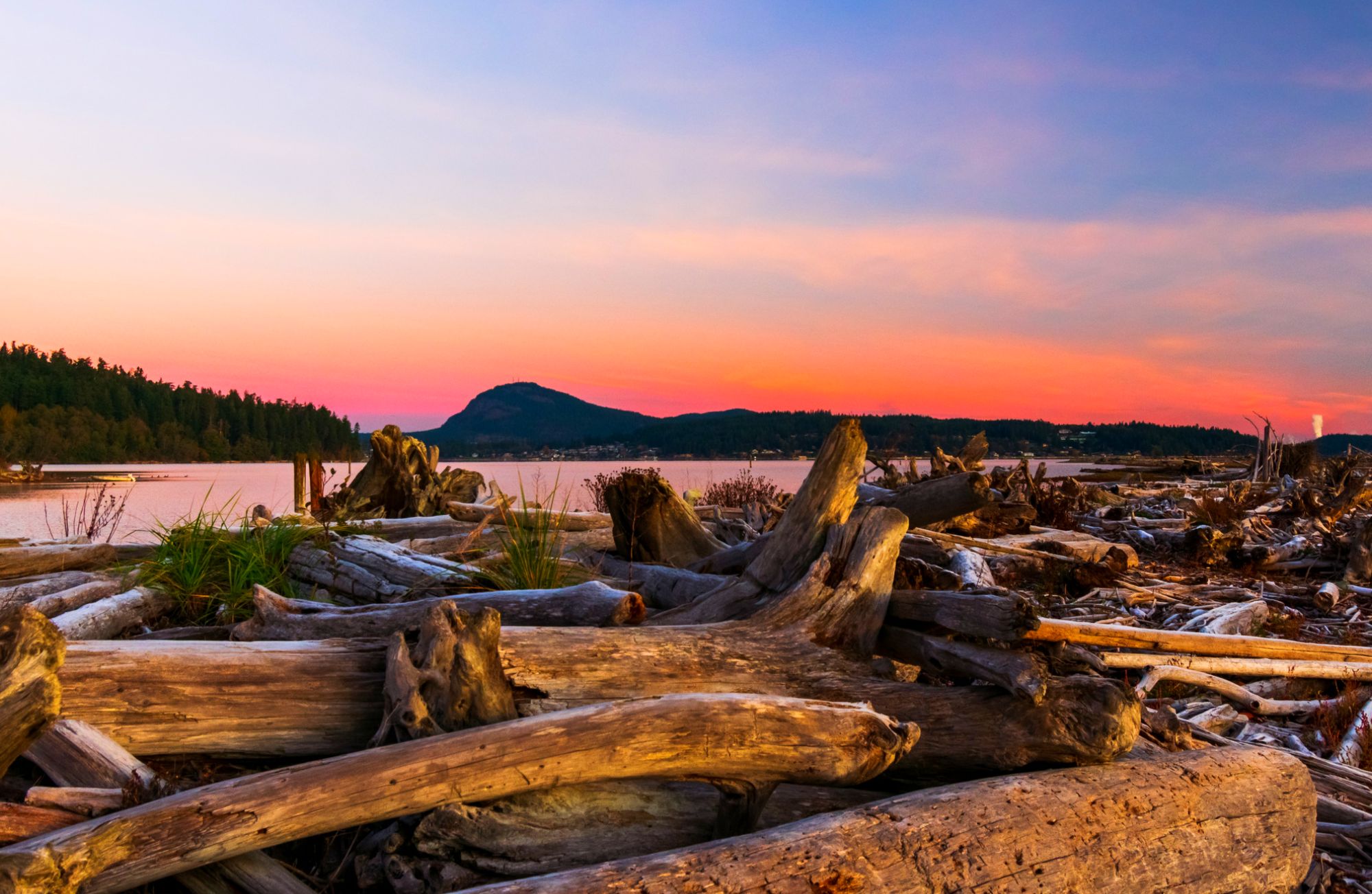
Bowman Bay
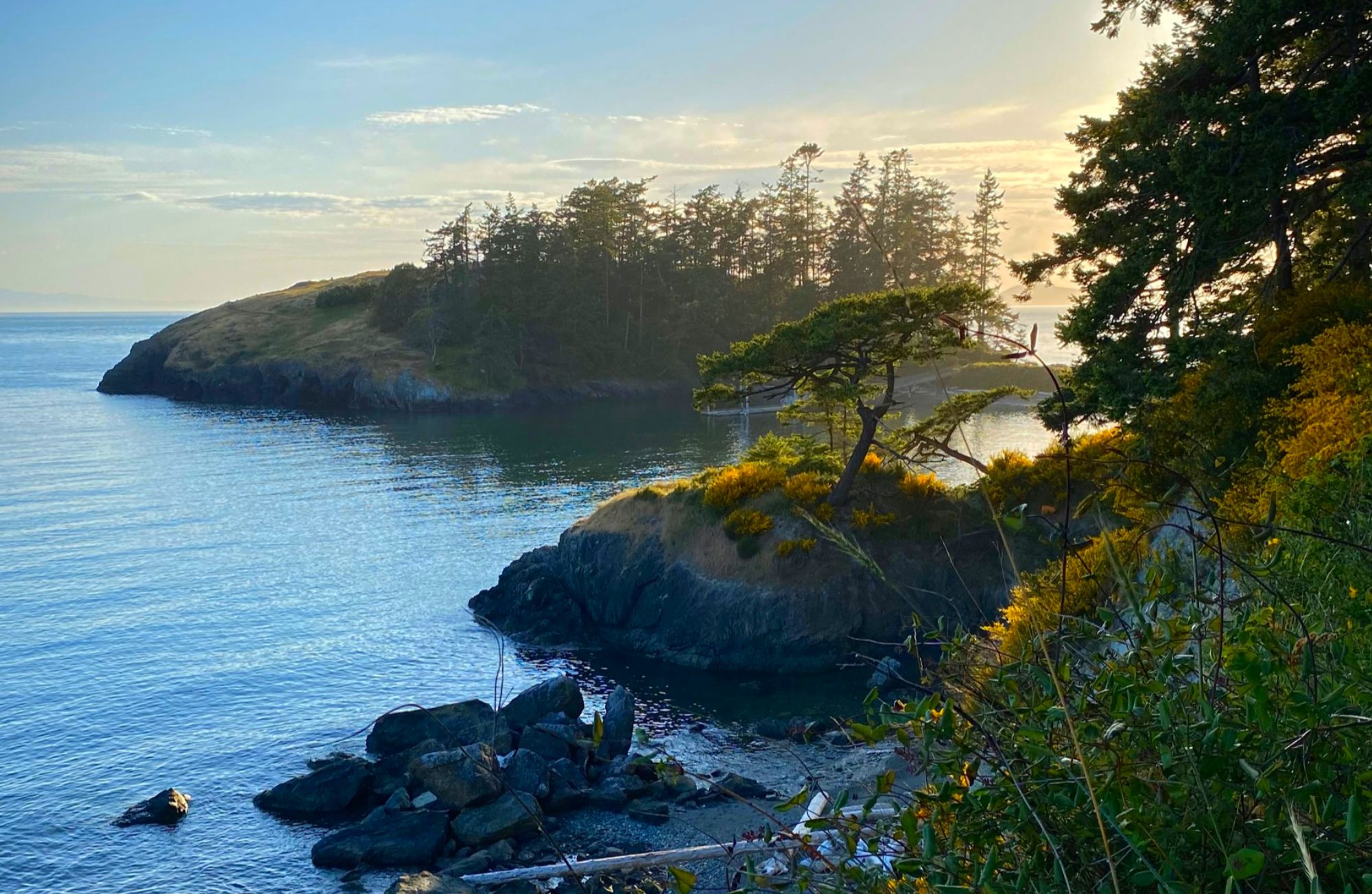
Photograph provided by @PNWBirdie
Bowman Bay, located in the stunning Deception Pass State Park, is a place steeped in history and natural beauty. For generations, this serene bay has been a source of wonder and a haven for explorers, families, and nature enthusiasts alike. Its tranquil waters, framed by rugged shores, provide more than just breathtaking views. These shores serve as a sanctuary for a diverse range of marine life. The bay is part of a vital ecosystem, offering a home to creatures such as harbor seals, sea stars, and migratory seabirds, all thriving in the pristine environment of Puget Sound.
Bowman Bay: For the adventurer
Beyond its ecological significance, Bowman Bay beckons adventurers, hikers, and seekers of peace to its shores. Whether you are hiking the nearby trails that weave through towering evergreens, kayaking across the bay’s glassy waters, or simply enjoying a picnic by the shore, the natural allure of this place is undeniable. The surrounding cliffs and wooded hillsides provide a sense of seclusion, making it an ideal spot to unwind and connect with nature.
Bowman Bay: Maritime history
But Bowman Bay’s charm doesn’t stop with its scenic beauty. Bowman Bay holds deep ties to maritime history and the local community. This bay has long been a safe harbor for seafaring vessels navigating the often-challenging waters of Puget Sound. Over the years, tales of fishermen casting their nets and sailors guiding their boats through the narrow channels of Deception Pass have been shared around campfires, passing from generation to generation. The area even served as a location for a Civilian Conservation Corps camp in the 1930s, where workers built many of the trails, shelters, and structures that visitors still enjoy today.
A place to make memories for a lifetime
The enduring spirit of community that thrives here is palpable. Bowman Bay has been a place where families come to create lasting memories. Whether it’s children exploring the tide pools, grandparents sharing stories of the bay’s history, or friends gathered around a campfire as the sun sets behind the distant Olympic Mountains. This bay, with its quiet charm, leaves an indelible mark on all who visit, reminding them of the delicate balance between humanity and the environment.
A place of reflection and reverence
Bowman Bay serves as a testament to the connection between the people of Whidbey Island and the sea that graces their shores. The bay’s rhythm—of tides coming in and going out—echoes the lives of those who have lived, worked, and played here. It’s a place that inspires reflection and reverence for the natural world, while also celebrating the resilience and history of the coastal communities that depend on it.
For those who venture to Bowman Bay, the experience is more than just a visit—it’s an immersion into the harmony of land, sea, and sky. Whether you’re drawn by the bay’s wildlife, its historical significance, or simply the peaceful atmosphere, Bowman Bay offers a unique opportunity to witness the enduring relationship between Whidbey Island’s inhabitants and the captivating marine environment that surrounds them. Here, amidst the beauty and tranquility, you’ll find a deep connection to the Pacific Northwest’s timeless spirit of exploration, community, and respect for the natural world.
If you have fallen in love with Whidbey and wish to make it your permanent home, connect with us here.
Ebey’s House at Ebey’s Landing
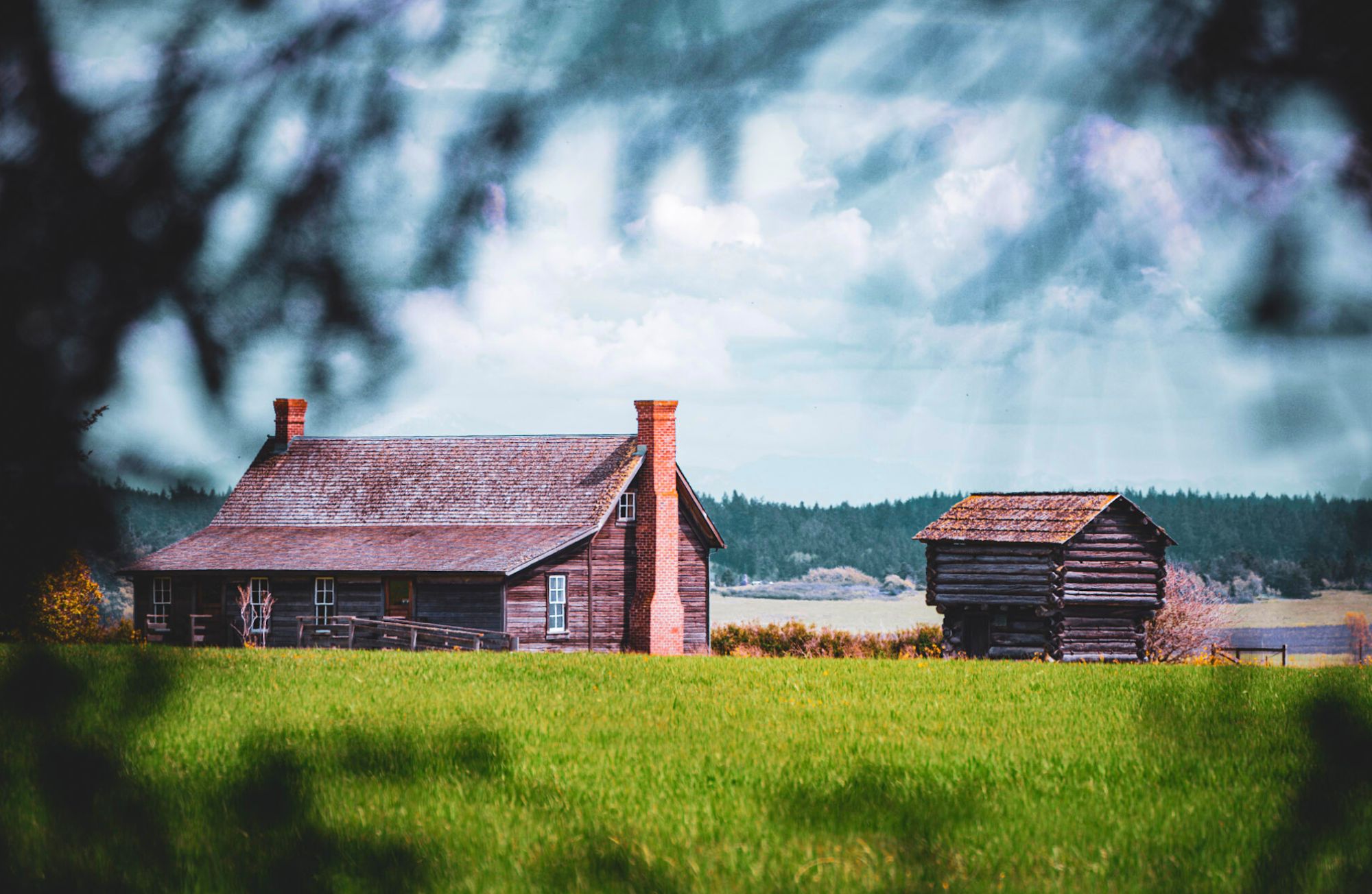
After making the trek across the Oregon Trail in the early 1850s to reunite with their son Isaac, Jacob, Sarah, and their children Mary, Ruth, and Winfield began building their home atop what we call today “Ebey’s Landing” in Coupeville. This scenic location looked over the incredible Admiralty Inlet and to their son Issac’s home across the way. They grew wheat, oats, and potatoes and raised chickens, pigs, oxen, horses, and dairy cows on their 320 acres. The main home and blockhouse still stand today. While closed most of the year, they are open to the public from Memorial Day to Labor Day under volunteer guidance. Other blockhouses can be located throughout the town of Coupeville.
Navigate to Ebey’s House at Ebey’s Landing:
Interested in learning more about Whidbey Connect with us here.
Check out the rest of Whidbey’s beautiful destinations from this series here.

Boating Under Deception Pass
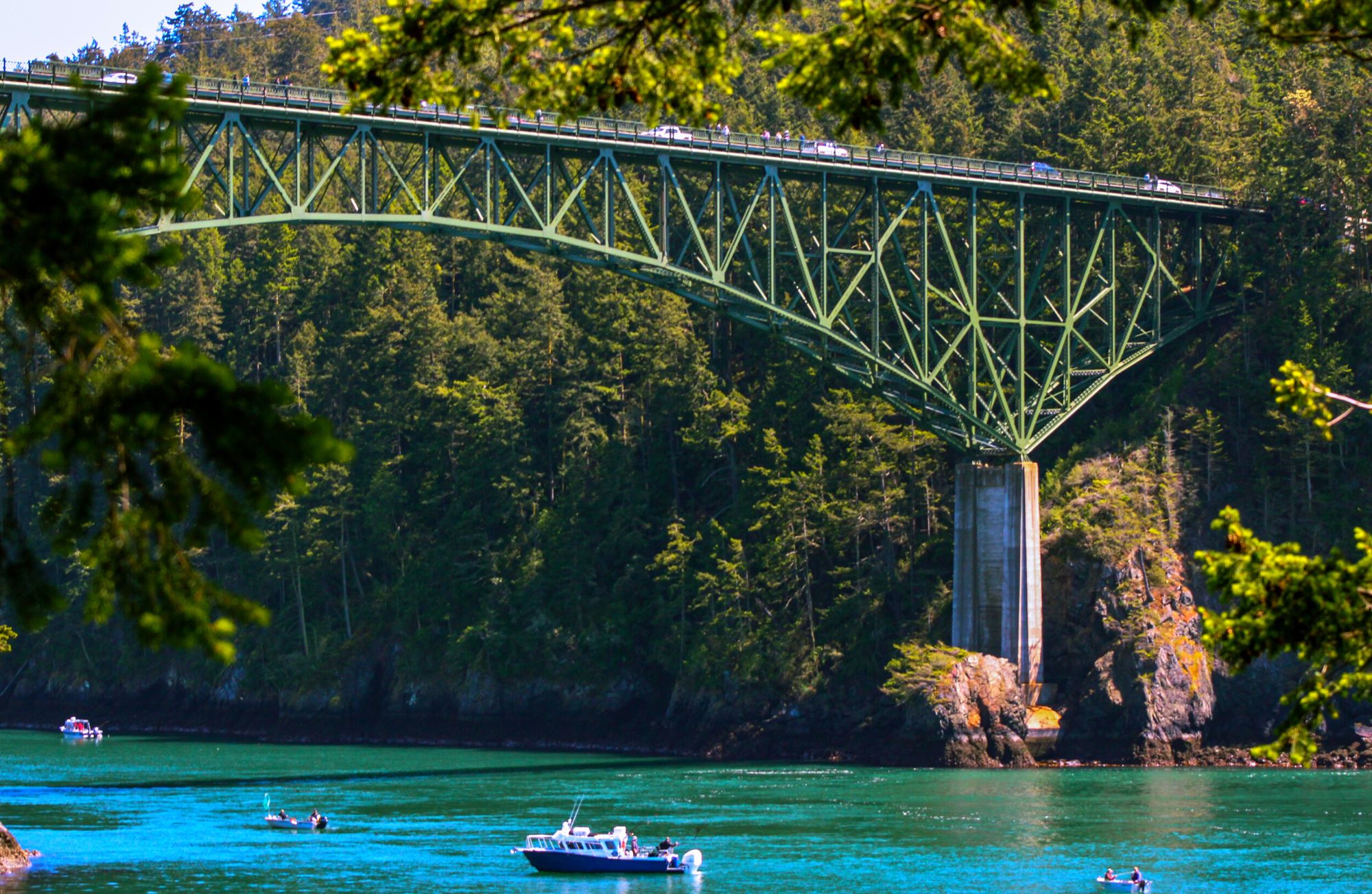
Have you ever thought about boating under Deception Pass? Deception Pass stretches over three islands creating two channels of water. The smaller narrower passage named Canoe Pass tends to be used for those traveling in kayaks as it is roughly only 30 feet in width. While both are framed by high rocky sides the larger of the two passageways has some of the fastest and strongest currents in all of Puget Sound. Boaters beware! 4 times a day waters from the Strait of Juan de Fuca (to the west) and Saratoga Passage (from the east) push more than 127 million pounds of water per second through this 150-foot passageway creating currents that can exceed 9 knots. While it is gorgeous, it is important for boaters to know when and how to travel safely through the pass.
This photograph was taken by Kyle Brown
If you would like to learn more about Whidbey Connect with us here.
You can also, check out the rest of Whidbey’s beautiful destinations from this series here.
Navigate to Deception Pass:
Hay Bale Farming
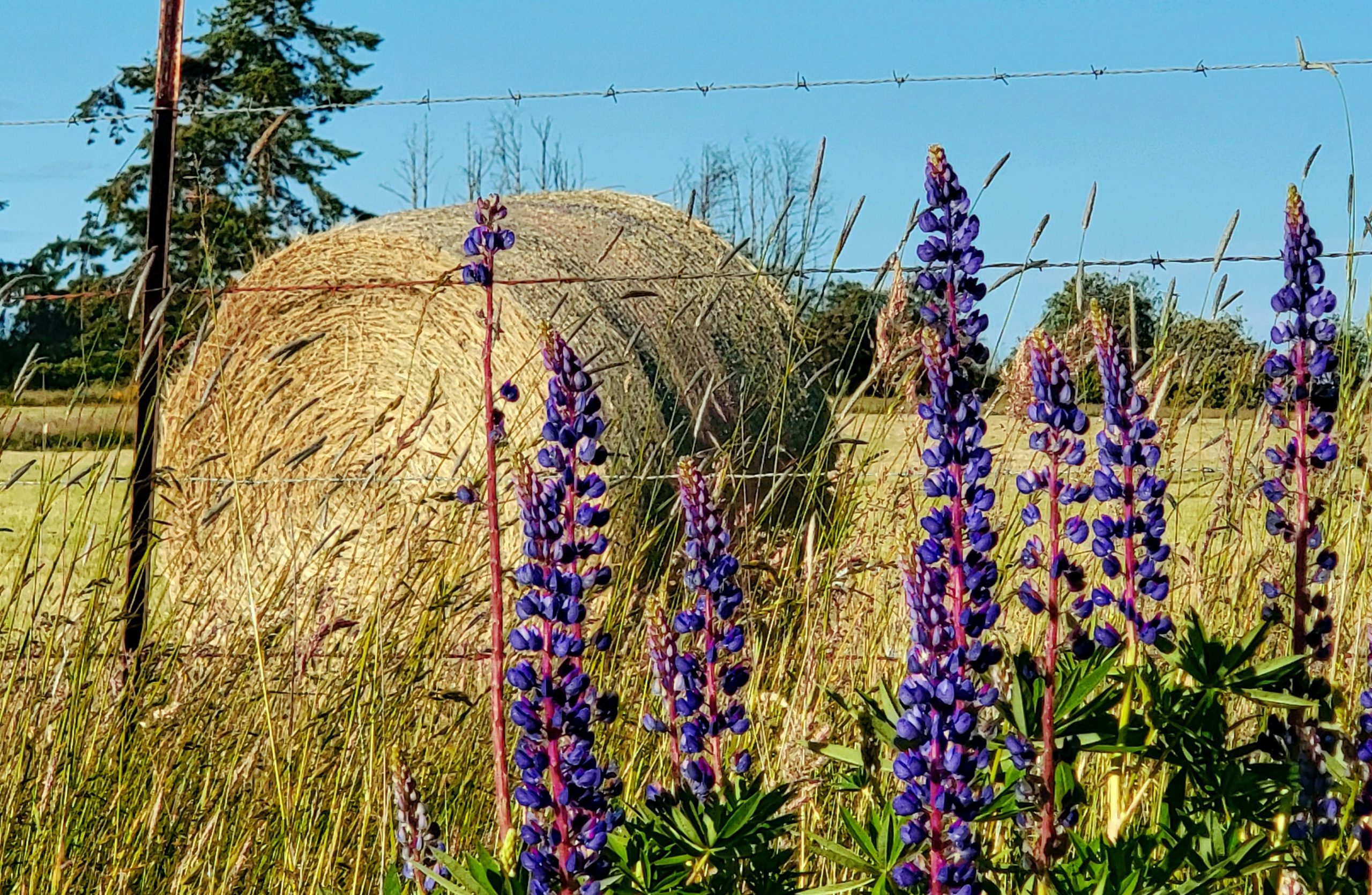
Hay bale farming is a part of Whidbey Island’s culture and iconic scenery. While you are driving around the island you are likely to see large oversized marshmallow shapes in farm fields. These are bales covered in plastic to reduce handling and eliminate the need for storage. We are lucky to live in an area that still has working farms for us to enjoy! With fall upon us, the baling season will soon be over. The weather will begin to change, the leaves will begin to fall, and the fields will start to turn from the various shades of brown to a lush green again.
Discover more by this photographer here.
Check out the rest of Whidbey’s beautiful destinations from this series here.
Admiralty Light House History
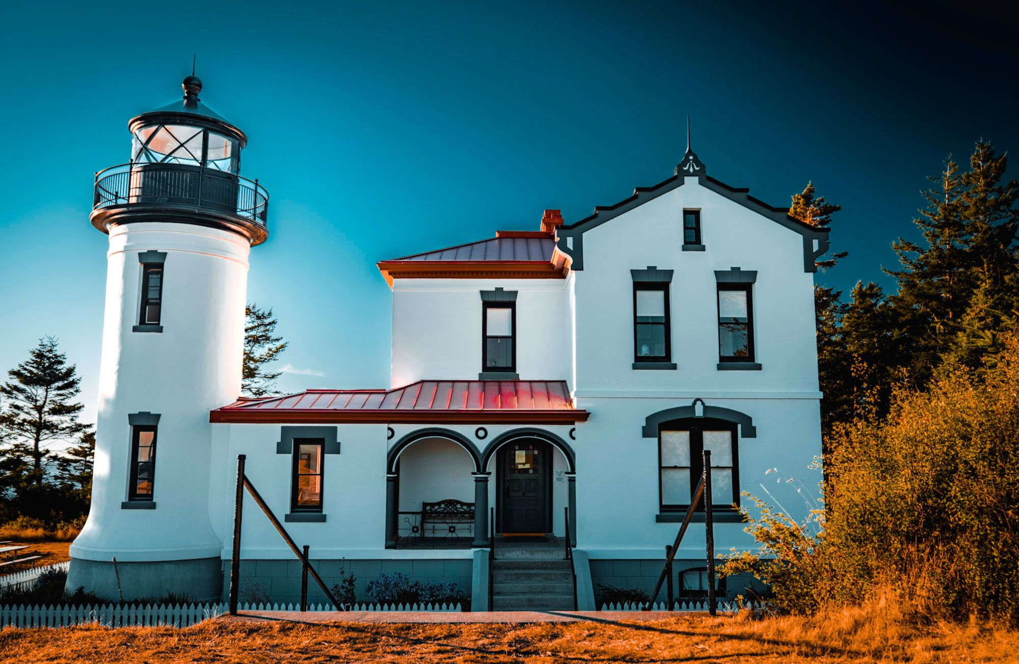
Photo by: @pnwdeparture
If you’re sailing into Admiralty Inlet from the open ocean Point Wilson sits to the West of you and Admiralty Head to the East. This entrance to the vast inland waters of Puget Sound is marked by lighthouses on either side to alert ship traffic at night. Let’s review some of Admiralty Light House History. The original Admiralty Head lighthouse was built in 1861 and had similarities to a church. It was later rebuilt in 1903 and decommissioned in 1922. Today it remains an iconic historical part of Fort Casey State Park. When open, the interpretive center features a real Fresnel Lens along with a fantastic collection of historic photos and even a gift shop. A Spiral Staircase leads to the lookout where you can enjoy expansive views of Puget Sound, the Olympic mountains, and watch the ferry as it crosses to Port Townsend.
Check out the rest of Whidbey’s beautiful destinations from this series here.
Fort Ebey State Park
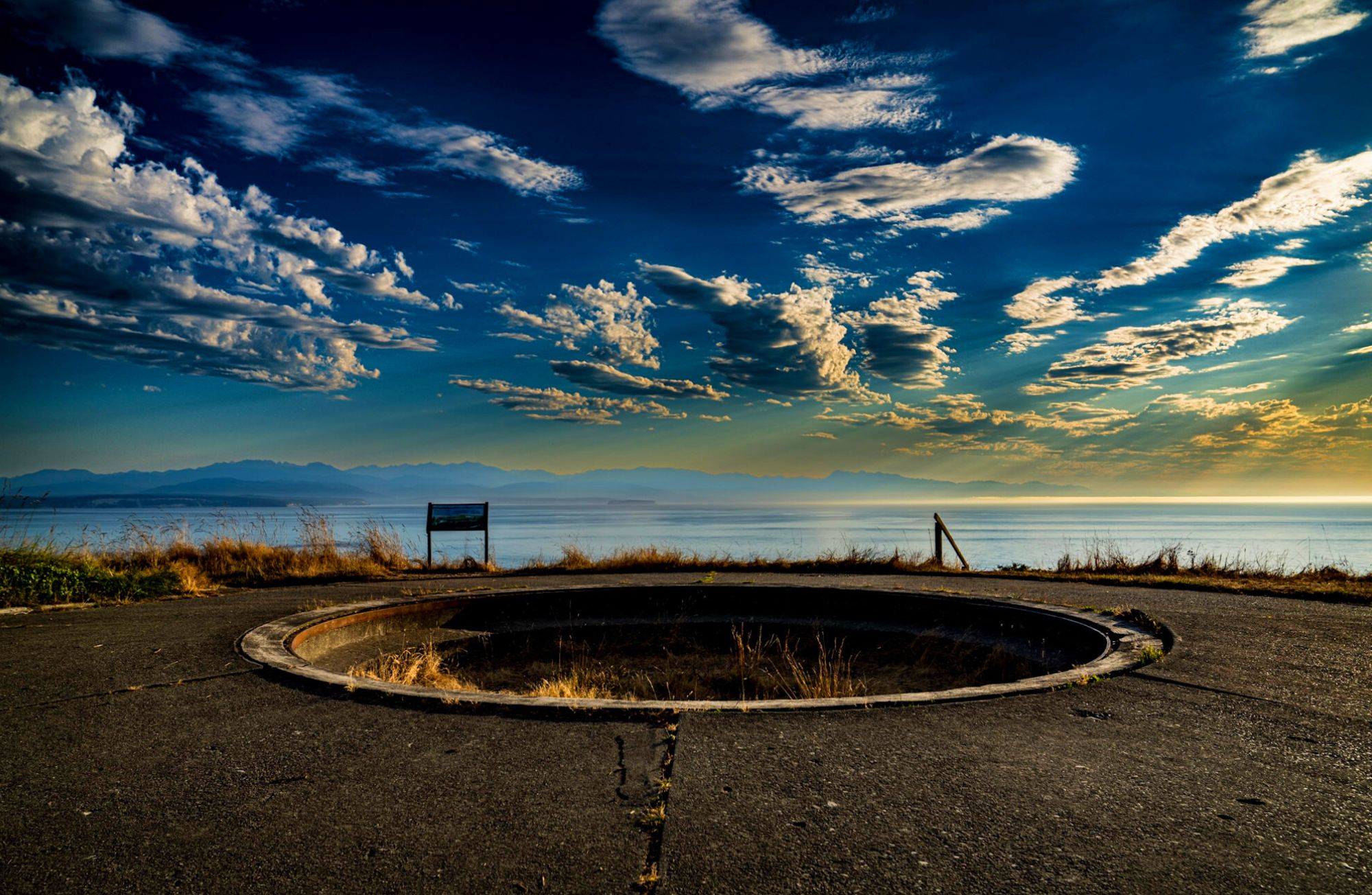
Fort Ebey State Park is so much more than just a pretty picture. These remnants of an old gun emplacement from 1942 overlook Admiralty Inlet and create the perfect recipe for a trip back in time. During World War II, this battery with underground rooms was dug into the high bluff as a defensive fort. Don’t forget to bring your flashlight for exploring the dark corridors. On clear days see if you can spot Point Wilson Lighthouse across the bay. In addition to 25+ miles of trails to enjoy and wildlife to observe, you might also spot a surfer or paraglider. Check out all that you can do at Fort Ebey here.
Check out the rest of Whidbey’s beautiful destinations from this series here.
Photo taken by @pnwdeparture
Sunset at Deception Pass State Park
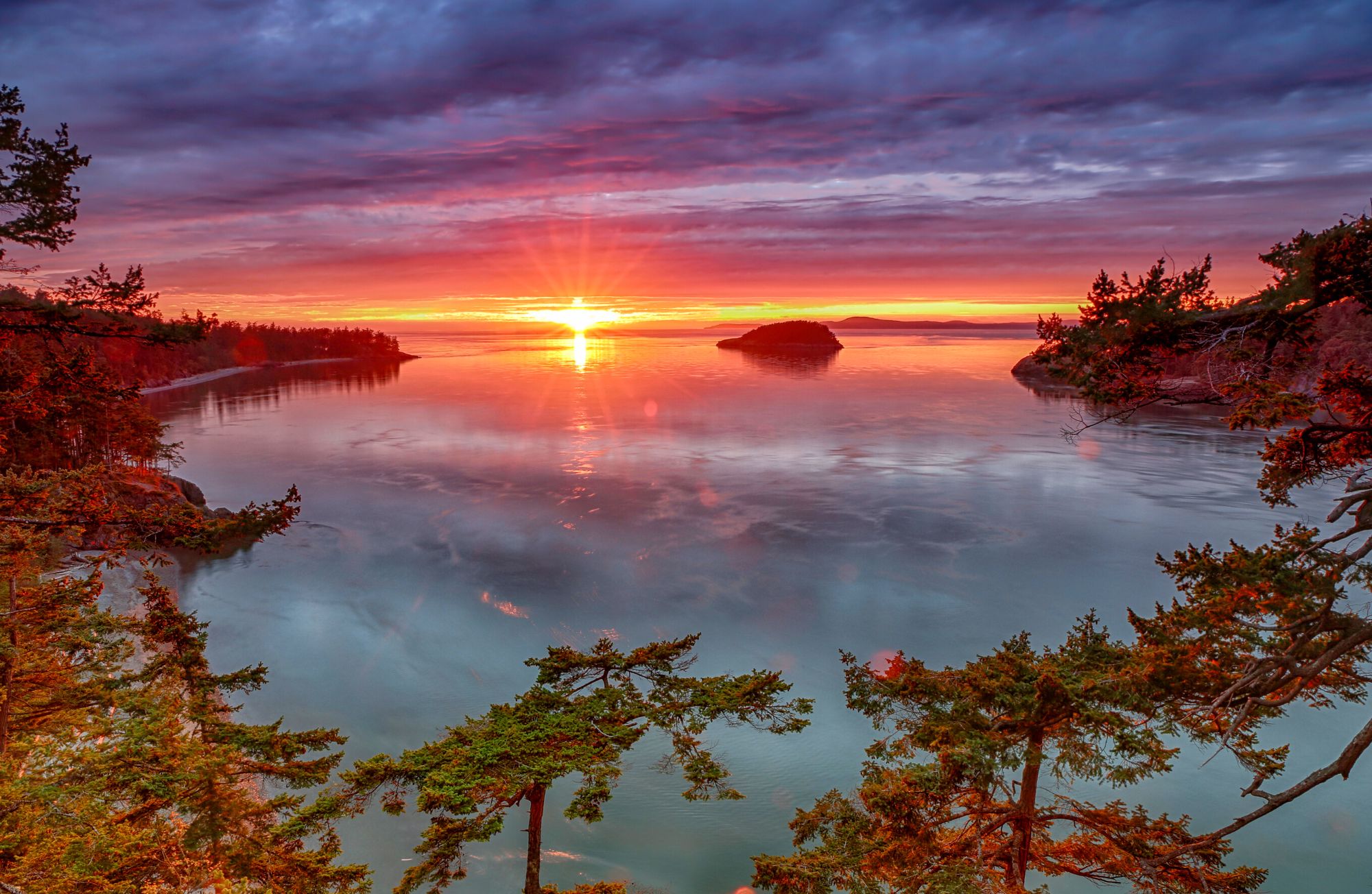
Destination Deception Pass! Have you ever stopped for a sunset at Deception Pass State Park? This image, taken from Pass Island looking out towards Deception Island at sunset, is one of the glorious scenes that keep Deception Pass the #1 most visited park in all of Washington State! There are so many ways to enjoy the scenery of this park. From the courageous and skilled boaters who brave swirling currents and tidal ranges over 12 feet apart to the day-use picnickers who enjoy West Beach tables barely a foot from the trunk of their car and everyone in between. Even in the depths of winter, there is magic in the evergreen forests and iconic PNW views to fuel the outdoor spirit of anyone who visits!
Check out the rest of Whidbey’s beautiful destinations from this series here.
Get directions to Deception Pass here.
