Tides around Whidbey

Find someone about six feet tall, then imagine another six-foot-tall friend standing on their head, not their shoulders but their head. Tricky but illustrative. They’d still have to hold their breath if they stood at the low tide line. The tides around Whidbey Island can rise and fall about twelve feet. That’s a lot of water. About twice a day, the Pacific Ocean flows into Puget Sound and flows back out. And yet, it usually happens quietly.
Why do Tides happen?
The moon and the sun pull Earth’s waters around the planet. The land gets in the way. Depending on the shape of the shore and the land underwater, the water piles up and drains. In Puget Sound that’s filling a basin 100 miles long across an area of about 1,000 square miles. It all has to flow past Whidbey. Imagine the traffic jam.
Where does all the water go?
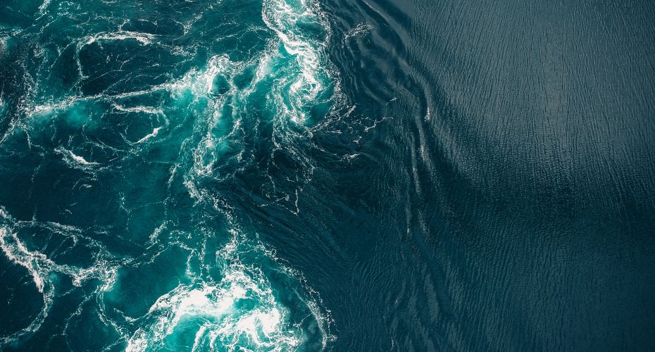
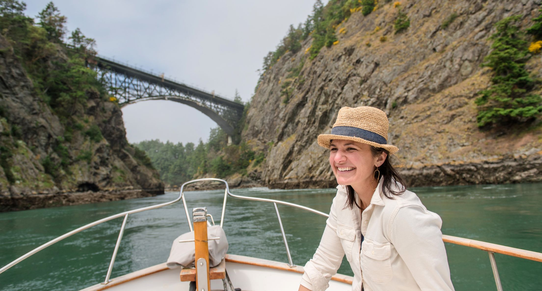
Most of the water flows past the west side of the island. Admiralty Inlet is miles across. Some goes through Deception Pass, which is much smaller, and hence the currents are much higher. Particularly at the Pass, but throughout Puget Sound, we can get white water conditions as currents scour geography, continuing the carving of the rocks and the gravels that define Whidbey’s shape. Swimmers, divers, and kayakers beware.
The currents are noticeable, but islanders are more aware of the tides. Sandy beaches can have shallow and long tidelands. Penn Cove, Dugualla Bay, Useless Bay are a few of the beaches where it can be a long walk from the high tide line out to the low tide line. Cultus Bay drains out so far that any crabs wanting to stay wet have a mile-long commute.
Where some see a lot of grey sand, birders and kids, clammers and beachcombers can find plenty to watch, play with, and harvest. Look up and watch eagles duel with osprey over fish. Long-legged heron may define the shelf before the drop-off to the Sounds’ incredible depths.
What should people be aware of?
Boaters may find themselves checking their charts for hazards, or rapidly retreating from the sound of something scraping their boat’s hull. Often enough, some boat will anchor at high tide, then find it tipping over as the water recedes. That’s one way to wake up. Fisherfolk may want to check on the depths they’re casting to. Crab pots need to stay submerged. Beach walks can be interrupted by a returning tide even trapping unassuming walkers in the worst scenarios.
Anyone setting foot out there should check whether they’ll be trying to walk on firm sand, something a bit squishier, and unfortunately, occasionally needing to be extracted from shoe-sucking muck before the tide comes back in. There are many stories of unaware tourists or newcomers getting stuck in an almost quicksand like muck. No one has lost their lives but plenty of flip-flops and shoes have been lost.
Homeowners have another perspective. Waterfront properties are considered premium, for good reason. Unobstructed views of the water and its wildlife are sweet. Being able to launch a boat from the beach can be convenient. Posting sunset or sunrise photos can make an impressive photo gallery on social media.
Homeowners pay for the privilege. Depending on their local geology, they may have to deal with seawalls, maintaining a slope, even accessing the beach in some cases can be difficult to impossible. Low-bank waterfront lots will get you to the waves a lot faster but uncomfortably so, for some.
Tides don’t always act the same way every day.
Every year there are tides that are higher and lower than normal. Near the New Year, there will be King Tides, tides that are higher than normal because of the relative position of the moon and the Earth’s tilt. Take photos, if you can. Scientists are trying to better understand how better to predict the time, size, and impact of the King Tides. They even have instructions about what to include in the photo to make it useful as data.
Storms happen, too. Storms usually happen with lower air pressure zones. Low pressure literally means less air pressure pushing down on the water. It seems like it wouldn’t have much of an effect, but check the Weather Channel’s commentary whenever an ocean storm is hitting land.
Put those last two things together and a storm surge during a King Tide can be impressive, and something to respect. Look at some of the driftwood logs that seem so far back from the waves. There’s a good chance some storm set them there. That’s a good time to be somewhere safer.
FEMA, the Federal Emergency Management Agency, has compiled data and produced maps for the nation’s coastlines because floods and storms happen. If you’re interested in a particular address or neighborhood, you can zoom in to see what the officials expect. Some areas have surprising results because some Whidbey land was wet but is now dry thanks to dikes. Bayview, which doesn’t have a view of a bay, once was an inland harbor.
Nature is wild, by nature. Waterfront views are wonderful, but that wonder takes a bit of effort to live beside responsibly. There is one solution to waterfront views that are more care-free: make sure it is fresh water. Lakeside houses don’t have to deal with tides. Their waters aren’t as dynamic, but can be equally peaceful. You just lose the bragging rights of owning something that touches the Pacific Ocean.
With so many options and such a variety of things to consider you need a shoreline and local real estate expert to navigate a purchase with confidence. Call us today and after we ask you a number of questions about your specific needs and goals we will match you with the perfect professional to guide the way!
If you are considering moving to a waterfront property, talk to your agent about how tides might affect your property. Don’t have an agent? Connect with us.
Our Three Gateways

Whidbey is an island. Fortunately, while many may appreciate our natural moat, life here is much easier because we have many threads to tie us to the mainland, and the mainland to us. If you move here you will need to add the bridge and ferries to your conversation starters because everyone has used them and has a story about them. Keep reading to learn about our three gateways.
Ah, but not everyone. Some people were born here and haven’t found a reason to leave because we have everything we need – almost all of which came by truck. Of course, babes and toddlers may be the only people who haven’t had the time to consider traffic.
Our Three Gateways
For everyone else, there are three main avenues: Deception Pass Bridge to Skagit County, the Coupeville Ferry to Jefferson County and the Olympic Peninsula, and the Clinton Ferry to Seattle and its suburbs. Few use them all. Commuters have well-practiced habits, making daily round trips via their preferred path. They know the prime times to miss the worst traffic, or at least how long it is going to take them to get to work. Assuming…
Driving to and from the island has assumptions and asterisks
Deception Pass Bridge is narrow, is in a beautiful park with windy roads, and tourists. Oh yeah, and winds. Windy roads and winds are an interesting combination that means gawkers may slow down to see the show, or are cringing as they drive across the tall gap as the road leaps between each island. Winds can slow trucks, and sometimes even topple high-light loads. The bonus of the bridge: it is free.
The Clinton Ferry
The Clinton Ferry is an option, for a fee. It is the second most trafficked route in the Washington State Ferry system, which is the largest ferry system in the U.S. They run the route every half-hour. Even with that, the boats can only cram so many cars onboard. Depending on the boat, many max out at 144 cars.
Check the signs as you approach Clinton. The ferry system posted signs along the ferry line, so you know if the wait is an hour or so. Wait time isn’t usually an issue. However, the line coming onto the island on a Friday in August can be three hours, and the same on Sunday as tourists finish their visit. On occasion there are wait times due to equipment issues, or lack of enough crew (want to work on a boat?). It is a commuter route, so it starts early and runs late, but don’t expect 24-hour service. Be glad that it runs in almost all weather.
Check out the WSDOT Ferry website to get a sense of how packed the ferry might be.
The Coupeville Ferry
All-weather does not describe the route from Coupeville to Port Townsend and back. On glass-smooth days, it can be one of the prettiest routes in the fleet. Whidbey in the east, though actually a bit north, and the Olympics in the west, though a bit south. Almost every ocean-going vessel heading to Puget Sound’s ports passes through, giving riders a plethora of views. Views of cruise ships, aircraft carriers, container ships, and even the occasional mega-yacht. The other thing that passes through that passage is over three-quarters of the tidal waters that flow in and out of the Sound several times a day. Making it tricky at times especially when the weather is not ideal. The west side of Whidbey has no deep-water harbors. The spot they use is narrow, shallow, and bordered by tidal currents strong enough to raise whitewater-style waves, and tides low enough to ground a less-well-designed ferry. Throw in some wind and white caps and see why that route is one of the most likely to have to cancel for safety’s sake.
By the way, both ferries can also deliver the treat of slowing to watch the whales go by. As one ferry worker noted, whale-watching boats charge a lot more for that experience. On the ferry, there is no extra charge.
Does that all sound too troublesome?
The reality is that it is all manageable because they all work more than well enough to sustain the communities of Whidbey Island.
There are alternative options to reduce your commute
Work from home and shorten your commute dramatically. Carpool and let someone else do the driving. Buses and carpools are busy for various reasons, one incentive is getting to avoid the ferry lines. Check out Island Transit here for what they have to offer.
That’s not all. It is only fair to acknowledge the Navy’s air facilities and a scattering of local airfields. Got a plane? Want to charter one? Watch the low-flying skies and see floatplanes making custom stops at residents’ docks and beaches. (Check with those companies for which sites are workable.) A couple to look at are Kenmore Air and DeLaurentis Airport.
Thinking about the water, Whidbey’s public marinas and private docks provide ways to get about regardless of bridges and ferry schedules. Finally, a real reason to have a boat. Anecdotally, at least one sailor claims to have powered from the southern tip of Whidbey to downtown Seattle in 35 minutes. That’s faster than weaving through King County’s traffic, but waves are probably not as comfortable as smooth pavement.
Islanders who regularly drive to the mainland learn when it is time to switch routes. Drive from Deception Pass Bridge to the terminal in Mukilteo and cross the halfway point on the island somewhere between Smokey Point and Marysville. Planning on taking the ferry to Everett but finding a three-hour line because of a ferry malfunction? Do a legal U-turn and drive up the island and down the mainland. Is the bridge closed to clear an accident? Drive to Clinton and the ferry and navigate to your destination from Mukilteo. Decided to go to dinner in Port Townsend, then learn that winds canceled the runs for the rest of the day? Welcome to the scenic tour of the peninsula that can include Hood Canal Bridge, The Kingston-Edmonds Ferry, and finally, the Clinton Ferry. Fuel up or charge up or both for that one, and yes, it’s done.
Island life is a bit different, but we adapt
We have our gateways over our moat. An island sets itself apart, but we benefit by our connections. Islanders tell stories, but delays are few enough, yet familiar enough that they become ice-breakers that we can share with strangers. They don’t just tie our cargo to our stores; the stories help tie us to each other. They are something we can share.
Now, as to upgrades to bridges and boats, well, that’s another source of stories. Stay tuned.
Considering moving to Whidbey? Perhaps you would like to discuss housing options. If you are not currently working with an agent connect with us here.

 Facebook
 X
X
 Pinterest
 Copy Link


